John Sheldon
May 12, 2017
News, Public Content, Space Economy News, Space for Earth News
Planetek Italia and Airbus Defence and Space have been awarded a contract for the supply of high-resolution Earth observation imagery and services by Eni, the Italian multinational oil and gas company. With the data and services provided, Eni will have actionable information at hand to improve their wide range of …
Read More »
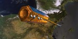
John Sheldon
April 14, 2017
Geopolitics News, News, Public Content, Space Economy News, Space for Earth News
PAZ, the satellite owned by the Spanish company Hisdesat, will soon increase the monitoring resources of the Airbus radar satellites constellation. Following its launch during the last quarter of 2017, PAZ will be positioned in the same orbit as the German owned TerraSAR-X and TanDEM-X satellites and form a high-resolution …
Read More »
John Sheldon
April 13, 2017
Events, Geopolitics News, News, Public Content, Space, Space Economy News, Space for Earth News
This is the last of three reports on the Turkish space programme. The first report was on the establishment of the Turkish Space Agency and the second report was on Turkey’s space launch ambitions. The attempted coup in July 2016 that sought to overthrow the rule of President Recep Tayyip …
Read More »
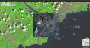
John Sheldon
April 10, 2017
Geopolitics News, News, Public Content, Space Economy News, Space for Earth News
Spaceflight Industries revealed on April 5, 2017, BlackSky Spectra, its on-demand satellite imagery service which enables customers to discover archive images and task new images from 13 high-resolution imaging spacecraft, all from one convenient web platform. BlackSky Spectra enables customers to easily look at the planet across every spectrum, from …
Read More »
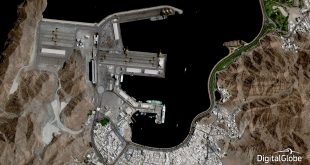
John Sheldon
February 27, 2017
Geopolitics News, News, Public Content, Space Economy News, Space for Earth News
MacDonald, Dettwiler and Associates Ltd. (MDA), a global communications and information company providing technology solutions to commercial and government organizations worldwide, and DigitalGlobe, Inc., the global leader in Earth imagery and information about our changing planet, today announced they have entered into a definitive merger agreement, pursuant to which MDA …
Read More »
John Sheldon
February 12, 2017
Events, Frontiers News, Geopolitics News, News, Public Content, Space, Space Economy News, Space for Earth News
Ian Christensen, Project Manager at the Secure World Foundation, reports for SpaceWatch Middle East, on the 12th Annual Ilan Ramon International Space Conference held in Herzilya, Israel, on 30-31 January 2017. The 12th Annual Ilan Ramon International Space Conference was held in Herzilya, Israel on 30-31 January 2017. Organized by the Israeli Ministry of …
Read More »
John Sheldon
January 23, 2017
Geopolitics News, News, Public Content, Space Economy News, Space for Earth News
UrtheCast Corp., the geospatial and geo-analytics company developing two Earth Observation (EO) satellite constellations, known as OptiSARTM and UrtheDailyTM, today announces that it has entered into a binding agreement with a confidential government customer for the sale and shared operation of the first two satellites in the OptiSARTM Constellation, the …
Read More »
John Sheldon
December 21, 2016
Events, Geopolitics News, News, Space, Space Economy News, Space for Earth News
The Israel Space Agency (ISA) and the Indian Space Research Organisation (ISRO) have agreed to collaborate on space projects during a recent Israeli visit to India. Avi Blasberger, the head of ISA, was accompanied by Israel’s Minister for Science, Technology, and Space, Offir Akunis, and former Minister of Science, Technology, …
Read More »
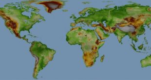
John Sheldon
October 11, 2016
Geopolitics News, News, Space Economy News, Space for Earth News
Airbus Defence and Space announced that customers can now be served with WorldDEM Digital Elevation Data for any point on Earth. Following the comprehensive global acquisition campaign and subsequent processing effort, WorldDEM data now is available for the entire World, including Antarctica and Arctic regions as well as Pacific islands. …
Read More »
John Sheldon
October 10, 2016
Events, Geopolitics News, News, Space, Space Economy News, Space for Earth News
Turkey is to build new satellites for its near neighbour Azerbaijan once its current satellites in orbit reach the end of their operational lifetimes. Azerbaijan currently operates its Azersky and Azerspace-1 satellites in both low-earth and geostationary orbits (160-2,000 kilometres altitude and 36,000 kilometres altitude respectively). Azersky is an earth …
Read More »
 SpaceWatch.Global An independent perspective on space