John Sheldon
December 28, 2017
News, Space Economy News, Space for Earth News
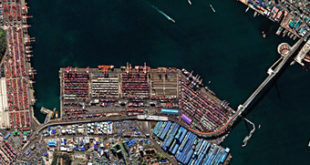
UrtheCast Corp. and its subsidiary, the Earth Observation company Deimos Imaging, have announced the signing of an agreement with SI Imaging Services (“SIIS”), a leading provider of remote sensing satellite data and exclusive worldwide marketing and sales representative of the KOMPSAT series, for the mutual global distribution of their respective …
Read More »
John Sheldon
December 15, 2017
Geopolitics News, News, Space Economy News, Space for Earth News
UrtheCast Corp. and its subsidiary, the Earth Observation company Deimos Imaging, have announced the signing of a strategic cooperation agreement with Beijing Space View Technology Co. Ltd., a leading provider of remote sensing satellite data and geospatial information services based in China, for the mutual global distribution of their respective …
Read More »
John Sheldon
November 27, 2017
Geopolitics News, News, Space Economy News, Space for Earth News
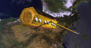
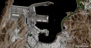
The high resolution radar, Earth observation PAZ satellite, intended primarily to address civilian surveillance needs and to cover many different applications including defence and security, will say its final goodbye to Spain. It will be shipped in December 2017 to its launch site in Vandenberg Air Force Base, California, USA. …
Read More »
John Sheldon
October 23, 2017
News, Space Economy News, Space for Earth News
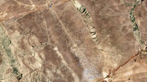
UrtheCast Corp., its subsidiary Deimos Imaging and e-GEOS (a company owned by Telespazio and the Italian Space Agency) today announced a strategic partnership to offer a unique combination of joint optical and radar sensors with ground stations. The collaboration will allow observation of the Earth day and night, regardless of …
Read More »
John Sheldon
October 1, 2017
Features, Geopolitics News, Space, Space Economy News, Space for Earth News, SpaceWatch.Global Opinion
As more countries around the world look to develop their own space capabilities, organisations, and policies, SpaceWatch Middle East’s Editor-in-Chief, Helen Jameson, examines the importance of technology transfer in developing space power in the Middle East and Africa. Space. It’s becoming a priority, and the fascination and realisation that what …
Read More »
John Sheldon
September 13, 2017
Geopolitics News, News, Space Economy News, Space for Earth News
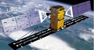
The production of Airbus’ four new very high resolution satellites, which together will form the Pléiades Neo constellation, is well on schedule for launch in 2020. They will join the already world leading Airbus constellation of optical and radar satellites and will offer enhanced performance and the highest reactivity in …
Read More »
John Sheldon
August 17, 2017
Geopolitics News, News, Space Economy News, Space for Earth News
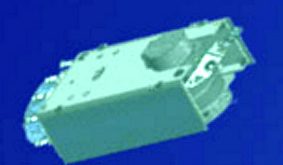
UrtheCast Corp. announced on August 14, 2017, that it has entered into a contract with a confidential customer for the development and delivery of a dual-frequency stand-alone Synthetic Aperture Radar (SAR) operational-class satellite as an “accelerator” for the OptiSARTM Constellation. The exact amount of the contract is not being disclosed …
Read More »
John Sheldon
June 7, 2017
Geopolitics News, News, Public Content, Space Economy News, Space for Earth News
DigitalGlobe, Inc., the global leader in Earth imagery and information about our changing planet, has announced it will launch a premium monitoring service, SecureWatch Sites, which provides current satellite images of high-interest, global locations on a regular basis from multiple commercial providers. SecureWatch Sites imagery is made available through the …
Read More »
John Sheldon
June 6, 2017
News, Public Content, Space Economy News, Space for Earth News
MacDonald, Dettwiler and Associates, Ltd. (MDA), a global communications and information company, today announced that it has signed an agreement to enable access to RADARSAT-2 archive data on GBDX, the powerful Geospatial Big Data platform of DigitalGlobe, Inc. GBDX is a leading platform for processing and analyzing geospatial data; it allows …
Read More »
John Sheldon
May 31, 2017
News, Public Content, Space Economy News, Space for Earth News
Airbus Defence and Space expands its WorldDEM portfolio with the launch of the “WorldDEM Ocean Shoreline” product. Developed in cooperation with the Center for Southeastern Tropical Advanced Remote Sensing (CSTARS) at the University of Miami in the United States, this new thematic layer provides highly detailed and accurate shoreline mapping …
Read More »
 SpaceWatch.Global An independent perspective on space