John Sheldon
November 25, 2019
Europe, Geopolitics News, Middle East, News, Region, Space, Space Economy News, Space for Earth News
Centre national d'études spatiales (CNES) President Jean-Yves Le Gall was at the opening ceremony of the Dubai Airshow 2019, attended by His Royal Highness Sheikh Mohammed bin Rashid Al Maktoum, Vice-President and Prime Minister of the United Arab Emirates and Emir of Dubai.
Read More »
John Sheldon
November 22, 2019
Geopolitics News, News, Region, Space, Space Economy News, Space for Earth News
Delegates representing ITU Member States have agreed at the World Radiocommunication Conference (WRC-19) in Sharm el-Sheikh, Egypt, to adopt an innovative new milestone-based approach for the deployment of non-geostationary satellite (NGSO) systems in specific radio-frequency bands and services.
Read More »
John Sheldon
November 21, 2019
Europe, News, Region, Space, Space Economy News, Space for Earth News
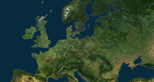
Materion Corporation and Swiss-based Synopta GmbH have announced the successful completion of the latest satellite as part of the Copernicus Earth observation project—an initiative that monitors the changing conditions and general heath of the planet
Read More »
John Sheldon
November 20, 2019
Africa, Europe, News, Region, Space, Space Economy News, Space for Earth News
Simera Sense and Space Inventor, Denmark, announced that they would collaborate through marketing Simera Sense's optical payloads, enabling earth observation satellite operators to sense the earth in more detail with smaller satellites from reliable platforms
Read More »
John Sheldon
November 20, 2019
Europe, Frontiers News, News, Region, Space, Space Economy News, Space for Earth News
Germany's largest private satellite manufacturing company OHB SE intends to start satellite launch services within two years, according to a 15 November 2019 report in Bloomberg Businessweek.
Read More »
John Sheldon
November 19, 2019
Frontiers News, Geopolitics News, Middle East, News, Region, Space, Space Economy News, Space for Earth News
The UAE Space Agency has announced its participation in Dubai Airshow 2019 as part of the efforts to enhance its international presence and showcase its current projects and future plans.
Read More »
John Sheldon
November 18, 2019
Europe, Geopolitics News, News, Region, Space, Space Economy News, Space for Earth News
The European Union's (EU) Permanent Structured Cooperation (PESCO) defence technology initiative announced on 12 November 2019 its decision to cooperatively develop several military space projects designed to enhance the defence and security of EU member states.
Read More »
John Sheldon
November 14, 2019
Asia Pacific, Europe, Geopolitics News, News, Region, Space, Space Economy News, Space for Earth News
Surrey Satellite Technology Limited (SSTL) has signed an agreement with Republic of the Philippines' Department of Science and Technology-Advanced Science and Technology Institute (DOST-ASTI) to provide a share of the tasking and data acquisition services from NovaSAR-1, the innovative small S-Band radar satellite launched into a 580km sun synchronous orbit in September 2018.
Read More »
John Sheldon
November 13, 2019
Geopolitics News, News, Region, Space, Space Economy News, Space for Earth News
On Monday, 11 November 2019 at 9:56 a.m. EST, 14:56 UTC, SpaceX launched 60 Starlink satellites from Space Launch Complex 40 (SLC-40) at Cape Canaveral Air Force Station, Florida.
Read More »
John Sheldon
November 13, 2019
Geopolitics News, News, Region, Space, Space Economy News, Space for Earth News
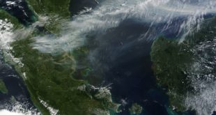
Earth Science Information Partners (ESIP), the global community steward for Earth science data professionals, has announced Operational Readiness Levels (ORLs) to make Earth science data more trusted and to improve data-driven decision-making during disaster response and recovery.
Read More »
 SpaceWatch.Global An independent perspective on space