
Edinburgh / Munich / Darmstadt, 31 January 2022. – Real-time risk and disaster intelligence provider, Mayday.ai, covering multiple disasters and all geographic regions, is leveraging L3Harris Geospatial’s technology to boost its disaster monitoring capabilities, the companies announced.
ENVI and ENVI SARscape, developed by L3Harris and sarmap SA, will grant Mayday.ai access to spectral high-resolution imagery. The technology will also enable the company to utilize the Synthetic Aperture Radar (SAR) domain.
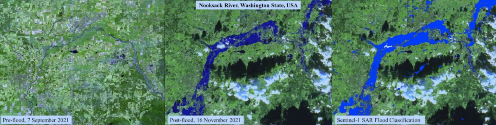
Mayday.ai has successfully fused deep learning models with automated workflows as part of its portfolio. The firm will now integrate the layers created by ENVI SARscape into its AI engine. This will complement the company’s platform already including real-time 3D visualisations and “before-after” analytics. In addition, the new technology will enable new real-time environmental and risk intelligence services.