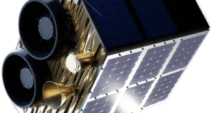
by Yvette Gonzalez, SpaceWatch.Global
 Berlin, April 14, 2021. Earth observation is an essential instrument for a variety of industries and government organizations. Accurate remote sensing can save time and money for different entities and improve people’s lives. To enhance the quality of this experience, industry experts are focused on tools and resources that will ensure the future of use-case has the highest impact possible.
Dragonfly Aerospace aims to do just that. Dragonfly Aerospace has a vision to create compact high-performance imaging satellites and payloads that are designed for large imaging constellations that provide persistent views of the Earth in a wide range of spectrums enabling unprecedented business intelligence and improving the lives of people around the world.
Their team constantly improves the quality of earth observation by developing a range of high-performance optical instruments. The next step in expanding their remote sensing technologies is the development of next-generation imagers with sub-meter resolution. We had a conversation with Dragonfly Aerospace CEO, Bryan Dean, and Optical Imaging System Engineer, Rikus Cronje where they shared new details about the main features of the Dragonfly microsatellite imagers and the features of their production and application.
Dragonfly has the HR-250 imager in the new product line. Please, tell us more about it?
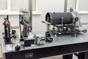
Dragonfly’s HR-250 is part of a new generation of high-performance light-weight imagers for a wide range of communicational and scientific applications. The HR-250 has 11 highly specific spectral bands with a native resolution of 1.4m. The imager provides an image swath width of 22km wide at 500km. One of our customers will use two of these imagers side by side to create a 44km swath which increases area coverage and reduces revisit times for image data.
How have you overcome the primary issues during the development of the imager? What technical solutions have been applied?
The main difficulty we faced during the development of the system design was the weight. In the finished system, we used composite materials, and the metal parts of the construction have a rather complex shape, so we were faced with the task of reducing the weight of the entire system as much as possible.
Another problematic issue was the development of alignment schemes and devices for assembling and adjusting the optical system. We also faced difficulty in finding suitable manufacturers because we have very strict specifications for the components.
What objects can this camera see from space?
The system is capable of observing objects of 1.4 m and larger from an altitude of 500km.
What types of industry tasks can the imager address?
Since the system has a lot of spectral channels, it is capable of solving a huge number of applied problems in the agricultural sector, ecology, geology, urban planning, cartography, water cover monitoring, and more.
What is the lifetime of this imager?
We have designed the imager for a lifetime of five years. But as a rule, such systems are designed with a large margin so it can probably last for a longer period.
What makes this camera superior to others?
The finished imager provides a wide swath, which means that we image a larger area during a single orbit. The optical system is designed to be as simple as possible while technologically advanced, which contributes to reliability during its use. The large number of spectral bands is also an advantage of other similar systems.
What informed the selection of this particular set of spectral channels?
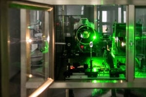
This set provides maximum comprehensive information, especially for the agricultural sector. It is intended to match the Sentinel-2 bands for sensor harmonisation. The Sentinel-2 images are widely used in the market and this allows users with existing analysis tools to increase the frequency of images and also use the higher resolution provided by the HR-250.
What design solutions have been applied?
In the design of the system, we used various materials in different nodes, including composite materials to compensate for thermal expansion and increase system performance. We have developed our own methods of step-by-step control of the system assembly.
Dragonfly is working on an improved version of the HR-250, or Raptor high resolution. What does the future hold in terms of technological progress?
We plan to use the acquired knowledge and skills to build and develop larger and more precise systems. Improving the alignment schemes and devices will allow the alignment of more sensitive payloads. Experience working with high-strength composite materials will allow us to outperform bulkier and heavier design solutions for sub-meter optical payloads.
What part of the design will be taken from HR-250 and what will be new for Raptor?
We have designed the focal plane and support electronics for the HR-250 from the beginning to allow it to be used on the larger Raptor imager also. They will not just be similar, they will actually be identical! This reduces the risk for the Raptor development significantly because this element will be flight proven early next year with the first flight of the HR-250. The optics of the Raptor imager will be an upgrade of the HR-250 optics. There are many lessons learned that we can take from the HR-250 design as well as from larger optics that our team has designed and built in the past.
What new features will be provided on Raptor compared to HR-250?
The main advantage of the Raptor imager is the sub-meter resolution image performance in a small volume and mass compared to previous systems of this class. The intention is to enable compact high-performance imaging satellites that can be deployed in large numbers to create daily very high-resolution imaging of the planet.
_________________
Dragonfly Capabilities
Dragonfly Aerospace satellites and payloads are based on a 25-year heritage of components and design approach dating back to the first South African microsatellite, SUNSAT, launched in 1999. SUNSAT was launched aboard a Delta II rocket from Vandenberg Air Base. Members of the team have worked on every microsatellite space mission since South Africa entered the space race.
Their fleet of products includes creating imagers that can be used in a modern CubeSat or microsatellite platforms to create compact high-performance satellite solutions. With the onset of more accessible CubeSat options for industry stakeholders, this technology is critical. For camera systems, Dragonfly is introducing the smallest earth observation CubeSat camera system. It is a revolutionary solution that enables obtaining high-quality photos from space. This became possible thanks to the result of integrating a compact and efficient optomechanical design with the latest approach in electronic design.
From their Gecko imager to their Mantis, Chameleon, and Caiman (currently under development) imagers – their products are making an easy-to-integrate imaging solution for CubeSat missions. Even customizable high-performance mass storage units that can be integrated into compact designs. Their Mantis offers multispectral and hyperspectral imaging capabilities. What does this mean for the user? Large, integrated, high-speed data storage, and a compact form factor that is optimized for integration with 2U or large CubeSat.
The Raptor imager, which as we learned is a high-resolution imager for larger microsatellites, capable of achieving sub-meter resolution (PAN) is part of Dragonfly’s super-resolution microsatellite cameras. These optical payloads are designed for precise spatial resolution earth imaging and mapping for a wide range of commercial and scientific applications. These microsatellite cameras raise optical payload performance to a new level of microsatellite earth observation. With earth observation data, users such as farmers can detect vegetation conditions. The technology will enable them to see healthy plants with more chlorophyll actively absorb red energy and reflect near-infrared (NIR). To get such precise data, we must use cameras with sub-meter resolution. The data collected from aerial imaging often has a better spatial resolution. But Dragonfly’s HR-250 and the Raptor sub-meter resolution imagers now incorporate this advantage into space imagery. It has 0.7 m spatial resolution and allows users to access detailed earth images as well as get more precise mapping.
The Raptor camera also covers very high spatial resolution and allows to get detailed earth imaging and precise mapping for key civilian or security applications.
Further information can be found: https://dragonflyaerospace.com


