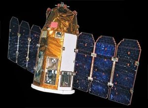
Imagesat International (ISI) is expanding its presence in the geographic data services market in a revolutionary collaboration with Balcony.io – a location based geo-communication platform. This partnership will enable geo-data validation by seamlessly aggregating the power of high-resolution satellite imagery with the reach of smartphone users on the ground, providing a new level of insight into developing events.
In a dynamic and evolving reality, the ability to quickly follow-up on initial triggers with additional information becomes critical. This new integrated solution offers a new source of insight based on the merge between high-resolution satellite imagery and a qualitative dimension provided by people on the ground.
For example, in a natural disaster scenario, once the exact scope of floods has been identified based on satellite imagery, precise requests for information are routed to users at locations of interest to provide additional information about the availability of potable water, electricity, open roads, etc.
Making the right decisions
ISI specializes in high-resolution photography from space using advanced satellites, along with research capabilities in data analysis and machine learning. The company employs analysts with extensive experience in satellite imagery analysis and an algorithm development team. These skills used by government and business organizations around the world to monitor location-based events and to validate legitimate news versus fake news.
Along with the use of satellites, Balcony’s crowd wisdom capabilities to selectively crowdsourced geo-information from locations of interest increases the accuracy of visual verification with a new level of human insight as an additional layer on top of the satellite imagery.
Both ISI and Balcony’s scope of capabilities offered within a single web hosted service, with multiple features uniquely developed to best support the daily workflow of government and commercial organizations for better and faster knowledge-based decisions.
ImageSat International is a global leader in end-to-end geospatial solutions. ISI solutions help its clients obtain high-resolution satellite earth imagery, conduct viable data analysis, and gain actionable insights, to better understand and act upon their geopolitical, environmental, and economic realities. With over 20 years experience in space imagery production and analytics, innovative technology and a multi-source data acquisition network, ISI delivers high-quality data, reports, and research insights.
The Balcony-developed geo-communication platform enables organizations to leverage their large and growing base of location-sharing mobile users to generate “awareness on demand,” supporting better-informed decisions in quickly developing scenarios. By integrating the Balcony SDK into an organization’s mobile apps, a user base is transformed into a source of unique location-based information. A set of fully hosted web tools enables users to generate requests for information and manage the geo-content generated. Founded by an ex-UAV operator and headquartered in California, Balcony’s platform is integrated with several leading players, representing hundreds of thousands of registered mobile users to date.
Original published at: https://spacewatch.global/2017/09/israels-imagesat-international-launches-geo-data-validation-click/
 SpaceWatch.Global An independent perspective on space

