The U.S. Congress has formally acknowledged India’s NAVIC global navigation satellite system (GNSS) to be an “allied system” in its finalized 2020 National Defense Authorization Act (NDAA), the legislative bill that outlines the U.S. Department of Defense’s budget, policies, and priorities for the coming fiscal year.
The acknowledgement of NAVIC by the U.S. Congress will mean that the GNSS system will be on a par with Japan’s GNSS Quasi-Zenith Satellite System (QZSS) and Europe’s Galileo GNSS. This will allow U.S. military and government users to utilise NAVIC along with the U.S. Global Positioning System (GPS), QZSS, and Galileo. Presumably, it will also allow similar privileges for India’s military and government to formally utilise GPS.
Navigation with Indian Constellation (NAVIC – is also a Hindi word for sailor or navigator), has cost the Indian Space Research Organisation (ISRO) U.S.$220 million for the orbital section and about U.S.$45 million for the ground segment. The NAVIC system provides two services: the Restricted Service reserved for Indian government and military users for now; and the Standard Positioning Service for civilian and commercial users in India and within NAVIC’s coverage area beyond, including the Middle East.
NAVIC’s coverage area ranges from much of the Middle East and East Africa through much of South- and Northeast Asia (except for Japan) and Northwest Australia. The Restricted Service signal provides position accuracy of better than 10 meters while the Standard Positioning Service signal will provide position accuracy of better than 20 meters throughout the coverage area.
Users outside of India can improve NAVIC position accuracy by using differential techniques where a network of fixed, ground-based reference stations broadcast the difference between the positions indicated by the NAVIC satellites and the known fixed positions. These stations broadcast the difference between the measured satellite pseudoranges and actual (internally computed) pseudoranges, and receiver stations may correct their pseudoranges by the same amount. The digital correction signal is then usually broadcast locally over ground-based transmitters of shorter range. With this method users can improve position accuracy from 10-20 meters to centimeters.
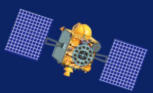
NAVIC comprises a constellation of seven Indian Regional Navigation Satellite System (IRNSS) satellites located in Geostationary orbit at 36,000 kilometres altitude.


