SpaceWatch.Global An independent perspective on space


Olga Nikolaevna Gershenzon is the deputy director general of the engineering company LoReTT, as well as a co-founder of the SCANEX holding. She has more than 25 years of experience in the field of practical application of remote sensing in various branches of economy. She supports the idea of accessible, decentralized solutions for receiving, processing and analyzing Earth images from space. Gershenzon is the author of more than 50 publications in Russian and international media.
Olga Nikolaevna, tell us please about your current activities.
I’ve been trying to make the access to Earth imagery from space more democratic for many years and I’ve been doing it with great enthusiasm. We started this long journey in 1990 with the creation of a school weather station and a station for receiving data from meteorological satellites. Now we are working again in the area of school education, having a huge experience in implementing projects based on real-time data from space. It is this experience and the fact that there are not enough specialists in this field that allow us to hope that we can be of interest to modern school students, particularly those who spend all their time on education and who are plums for numerous educational platforms, competitions and education centers.
I am still a co-founder of the ScanEx holding, I have a 5% stake, but currently I do not take part in the operational management of the company. The history of ScanEx began with the development of educational technologies, for example, a weather station for school students. 29 years ago my husband, our partner and I founded the ScanEx company (www.scanex.ru). We have developed a new space information receiving station, which was called LoReTT – Local Real Time Tool. This project is a natural extension of our mission to make access to the images of the Earth from space more democratic by making it faster, more simple and less expensive. In April 2017, we founded the LoReTT company (http://lorett.org/), in March 2018 it became a resident of the Skolkovo innovation center, in the summer of 2017 we took part in the Internet Initiatives Development Fund acceleration program. We did it to choose the most promising niche for implementation. Education turns to be one of the most interesting niches, but it is also the most complicated and the most expensive one.
Has the ‘LoReTT’ laboratory complex for satellite monitoring been patented yet?
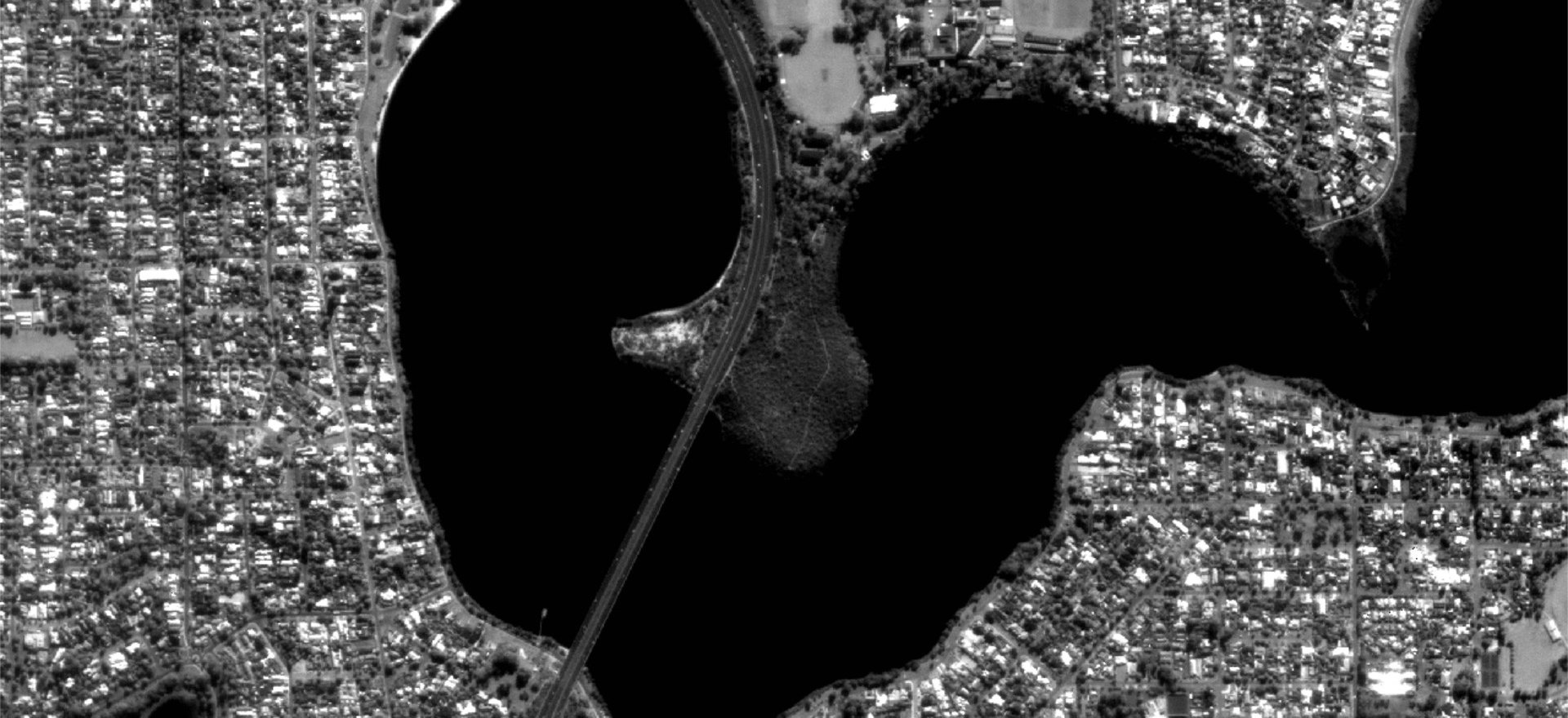
of the images taken by Aist-2D satellite showing the vicinities of the city of Perth (Australia) and its port: from the overview to the details of the bridge over the Swan River. A highly detailed satellite image was taken with the help of the LoReTT complex on June 15, 2018.
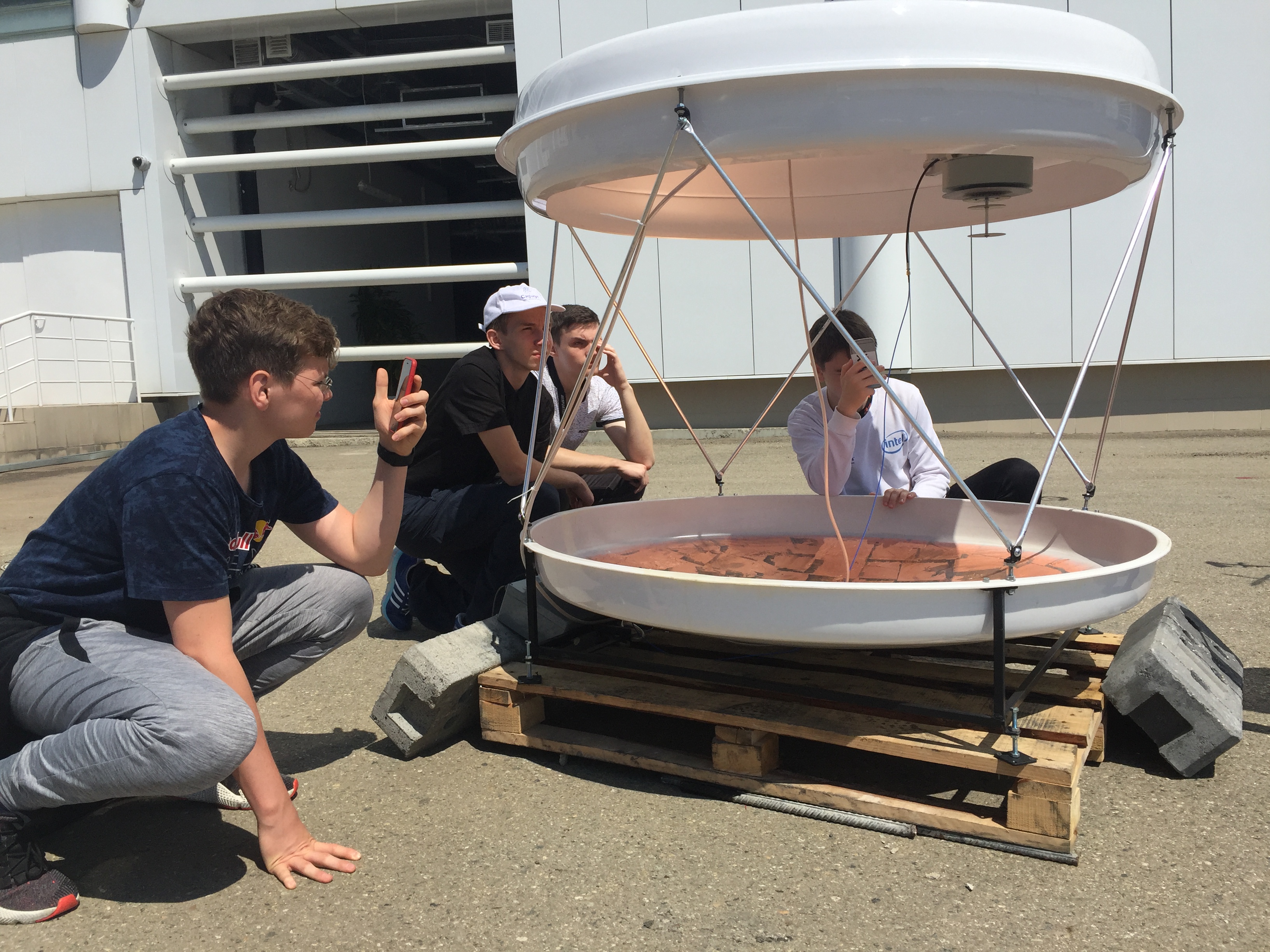
A few weeks ago we received a positive international search report from the European Patent Office. In other words, there are no analogues of our technology used in the ‘LoReTT’ laboratory complex for satellite monitoring. The ‘LoReTT’ complex is an instrument for receiving data from satellites in real time within a radius of up to 200 km from the installation site. The antenna that receives images of the Earth from space, has a rotational device which isn’t conventional for such technologies, and the antenna feeder moves above the fixedly mounted antenna mirror instead. This makes it possible to simplify the antenna design, making it more mobile, versatile and substantially cheaper than its analogues.
Let’s go back to history. In 1996, we revolutionized the whole industry with our Personal Space Data Receiver Station. That complex was the first one that allowed an end-user to receive data from remote sensing satellites directly to a personal computer. In 1998, having installed 14 such stations across Russia, we realized that we couldn’t enter the global market without having our own satellites! We conceptualized an idea that we called the Transparent World and started moving in that direction. Our path seemed endless. As a result, the SPUTNIX company was born, the first private company in Russia to launch its own satellite.
The final goal of launching a satellite constellation was to create the greatest possible demand for terrestrial stations due to the fact that the end-users were supposed to have a free and unlimited data downlink. It is this approach that has created a high demand for the ‘LoReTT’ station today.
We started working on the idea in a garage. We were moving forward step by step for two years, retreating, remodeling something, making mistakes and sometimes doubting. And here came our first success, which would have been impossible without the support of the Aist-2D satellite developers. On June 15, 2018, we received data from the satellite with the ‘LoReTT’ station, which weighed 20 kg and could be installed wherever you wished.
You’ve mentioned that the ‘LoReTT’ startup has an educational component. What exactly does it include?
I think the ‘LoReTT’ station is our revolutionary development and the beginning of an absolutely unique educational program, which only Russia has so far. We used to offer the students the data with a resolution of 4 km per pixel back in the 1990s, but now the resolution is up to 50 cm per pixel. Some people oppose us, they don’t understand us, they don’t see business in that. They ask, what do children need 1 meter resolution at their own receiver station for? Furthermore, everything can be found on the Internet. But the problem is that Yandex Maps and Google Earth don’t provide up-to-the-minute images of the Earth from space. The problem is that up-to-date information on an particular area can be obtained only upon a prior request and for a very high price. The solution is the ‘LoReTT’ hardware and software complex that will enable you to receive up-to-date images from space onto your personal computer which can solve many practical problems.
So, there’s this hardware-software complex that can be used in educational and innovation projects in three different ways. The first one is a constructor complex for engineering education. The second one is the complex used as a tool for providing access to ultra-high spatial resolution data for organizing project activities using real-time data. The third one is the complex as a tool for creating an environment for the development of services and/or mobile applications. It can be used by collective use centers or through hackathons, including international ones.
What other projects does your startup have?
Now we are holding a competition called Young Seals 2019 as part of the Planet Watch partner program (spacecontest.ru). The program is organized by The Skolkovo Institute of Science and Technology (Skoltech), the ‘Talent and Success’ Educational Foundation, the Innovation Support Fund and the Roscosmos State Corporation. Participants of Young Seals 2019 will work with space images of the White Sea water area in order to find young harp seal rookeries on the ice. In the first weeks of life, young seals can’t move very fast. That’s why they often become victims of ships if they get in the way of their routes. School students will identify young seal rookeries with the help of space images (by studying the biological features of seals’ lives, climatic and weather aspects of the region, characteristics of the ice cover and other issues). We will then pass this information on to the public authorities to correct the ships’ heading and avoid the animals’ rookeries.
Students from 8 to 11 grade can become participants in the Young Seals 2019 contest. The registration of participants starts in September 2018. The first selection round will be held in September-October 2018. 15 winners will go to the Space Shift at the Sirius Educational Center in Sochi in March 2019, where they will take part in rescuing young seals and continue to improve their knowledge and skills in working with space images and geoportal technologies.
By the way, in 2010 our team worked on the detection of young seals’ rookeries in the images from space. Then we managed to raise this problem to the level of the federal agency: a special order was issued by the Federal Agency for Maritime and River Transport. According to this order, if there is any information about young seals’ rookeries on the route of an icebreaker, the vessel is instructed to change its course.
Another example of our educational work is a new profile called ‘Analysis of Space Imagery and Geospatial Data’ that was included in the Olympics of the National Technology Initiative (ONTI, http://nti-contest.ru/). In the 2018/2019 academic year, we will develop a new profile for ONTI together with our colleagues from Transparent World. This Olympics has participants from different parts of Russia and it is included in the list of Olympiads of the Russian Council of School Olympiads, which gives additional points to the Russian State Exam.
We have one interesting project more, which is providing weather data on the cloud cover via the MODIS / Terra and Aqua data service in real time (http://lorett.org/services#ul-id-71-11). It is not an educational project, but it is being done for the first time. It’s a unique project globally. We provide users with real-time (‘on-the-fly’) space imaging and data products from the MODIS radiometer data on the Terra and Aqua satellites using standard algorithms on the cloud coverage and the temperature of the upper edge of clouds in approved target areas. We tested the method and verified the results in collaboration with the Institute of Radar Meteorology.
How do you promote your educational projects?

In July we participated in the Space Shift of the ‘Big Challenges’ program at the Sirius Educational Center in Sochi. We set the task for the children to develop a station for receiving and processing images of the Earth from space in the L-band almost from scratch. As an example, we brought in Sochi a set of data receiving complex which works with the data from ‘Lenticularis’ meteorological satellites and which is the latest project of the ‘LoReTT’ company. It’s shaped like lentils. As a result, the students at the Sirius Center developed a new version of this station.
In the spring of 2018 we worked with 5-7 grade students of the Khoroshevsky school in Moscow. We trained their skills in deciphering space images and using geoportals.
In the next academic year we are going to introduce some elements of project activities in the teaching of geography. Unfortunately, this subject is often taught in a boring way. I graduated from the Faculty of Geography of Moscow State University, but at school I hated geography, and fell in love with this subject only when I began to prepare to enter the Faculty of Economics. I needed to take geography, and my friend, who was a geographer, told me about his faculty. This science blew my mind away and I changed my mind about the faculty. I have never regretted it!
Do your activities overlap with those of the Roscosmos State Corporation?
The ‘LoReTT’ company and Roscosmos don’t interact a lot yet. But in June of this year we obtained highly detailed data from the Aist-2D satellite with the help of the ‘LoReTT’ station for the first time. The Aist-2D satellite was created by the specialists of the Progress Rocket Space center, and the instruments, which were installed on it, had been developed by scientists, students and postgraduates of the Samara State University.
By the way, our station can receive data from the Russian Resurs-P (‘Resource-P’) and Canopus-B satellites. In May of this year Volodya [Vladimir Gershenzon – General Director of the ‘LoReTT’ company, – Ed.] spoke on the training program of the industry personnel reserve at the invitation of Roscosmos.
I have to say that Roscosmos has recently started to participate more in educational projects, and that’s great.
How did you come to the idea of using the remote sensing data technologies?

of the images taken by Aist-2D satellite showing the vicinities of the city of Perth (Australia) and its port: from the overview to the details of the bridge over the Swan River. A highly detailed satellite image was taken with the help of the LoReTT complex on June 15, 2018.
I’ve always loved pictures from space. My thesis was called ‘The effect of the weather on children with arterial hypertension’. When I had my two kids and my parental leave finished, I learned about personal computers and I brought one of them from the U.S. I worked at the meteorological station of the Moscow State University, and hired programmers to digitize the official data. Once Volodya Gershenzon, my future husband and business partner came to see us. He had a company called ScanEx at the time, which was developing a weather station for school students. Volodya asked if we had a register that could be used for monitoring. The key moment was my answer: ‘We need to develop a station for receiving space data so that children can see and understand the peculiarities of atmospheric circulation’. He thought and agreed. That’s how it all began.
About the interviewer:
Evgeniy Ryzhkov studied space programs for two years in Japan and worked as a technical translator from Japanese at various factories. He is currently an editor and reporter with the ‘Novosti Kosmonavtiki’ magazine.