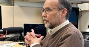


Simon van den Dries is the General Manager at Spire Maritime. Spire is a space-to-cloud data and analytics company that specializes in the reaching of global data sets powered by a large constellation of nanosatellites. This past week, on 11th June 2021, space-interested students Bano Barzingi and Chiara Moenter, sat down with Simon in the Space Café BeNeLux to discuss his work at Spire, as well as the factors of space sustainability trends and the multitude of uses of data from space for a better future.
 Spire was formed by founders from three countries scattered across the globe, united by a common desire to build a better planet. And has 6 main location points on 4 different continents, one of these locations is actually very interesting – Luxembourg. Currently, space and satellite sector accounts for almost 2% of Luxembourg’s GDP, having grown from essentially nothing three decades ago. The country’s space sector now consists of more than 50 companies and two public research organisations that cover various segments of the industry.
![]() Simon is the General Manager of Spire Maritime, one of the four business units run under Spire. The four sectors are Maritime, Weather, Space Services and Aviation.
Simon is the General Manager of Spire Maritime, one of the four business units run under Spire. The four sectors are Maritime, Weather, Space Services and Aviation.
“And then Spire Maritime, which is all about a global industry where we track all 300,000 vessels in the world on a daily basis on an every 10/15 minutes basis.”
Spire offers customized satellite services, specifically, data services on customized settlements. If a customer wants to take pictures in a specific way, and they have their own optical lens, Spire can include this in their satellite design.
So how do launch these satellites?
Spire makes use of nanosatellites which are “approximately the size of a box with a decent bottle of wine”. During a launch, there are usually three to six nano satellites being sent up at the same time.
“Not sure whether you’ve seen those movies, but it’s beautiful. They are put in a spring box in a box, and shipped that way. They then put the satellites in the rocket and then the spring pushes the satellites out at a 450 km altitude. And they reach between 450 km and 550 km altitude, the same altitude where the International Space Station is”.
Spire’s satellites are able to use the same satellite to detect an aircraft, to conduct weather observations and to detect a vessel. Each of these requirements is present within the satellite technology and the engineers need to balance this.
The Usage of Data
In terms of data collection, Spire looks to be diversified, involving the data collection of different segments.
“So that if one business is more difficult, that you at least have other businesses that can complement the threat. So it’s a sound diversification strategy. On the other hand, if you look at an aircraft or a boat, from a technical point of view, they’re both moving objects, and they both transmit the signal”.
Furthermore, there are many customer bases that make use of all data. For example, large consultancy companies that are giving strategic advantage to customers, like to have extensive data.
“We are collecting Earth information, anything information that we can detect from space, which is relevant for Earth. We are here to collect data from space to solve problems on Earth”.
An example of customer bases is government and security. There are governments that buy data to protect their waters, to detect illegal activities such as illegal fishing. There’s a lot of illegal fishing and from Earth, it is difficult to detect. But fortunately, from space, there’s nothing hidden. So Spire has customers like Global Fishing Watch and other NGOs that use the data to go after the culprits of illegal fishing. The illegal activities are detected quite easily. The economic zones of every nation and every fishing zone are known.
“So for example, there’s a lot of fish around the Fiji Islands. And you’re only allowed with a Fijian boat to do fishing in Fiji. But we know of course, if there is an Australian one. Both coming into that moment, the moment that the Australian both enters Fiji, we can create an alert area and we say okay, is this really legal or not. And then certain vessels, of course, have a permit. So the local authorities can detect if they are allowed to enter or not by knowing what kind of vessel it is, how it is registered, by which flag and in which geographic zone it is located”.
In order to collect the data from the satellites, the precondition is to have a good terrestrial connection, hopefully even a fiber connection. From there, the data enter into the fiber connection and goes to the data center.
“We have contracts with Amazon Web Services and Google Cloud Platform and a few others, but the data goes straight into the data warehouses. And from there, we start to clean it, we start to translate it, we start to aggregate it to refine the data. So there’s lots of things that happen. That’s no longer the Space Engineers that do this, the data engineers are now involved”.
Sustainability in Space
Spire was founded on the belief that it would make the planet better and that we as humans are here with a purpose.
‘’We are here to actually make a better Earth and also a better space. I would think environment and water are two clear SDGs that I can see that we contribute to the environment starting with space debris. So, Spire has been one of the founders of the space debris Foundation, which is everything to do with detecting what kind of debris we have, and then working together on policies for satellites.’’
Next to issues such as Space debris….
‘’We look at the weather, and the airspace in the atmosphere, but also the weather, the soil, or the ocean. So we can even measure the weight heights, we can measure the wave height on the road, and we can also measure soil moisture. And if there’s one thing really important also in the SDGs, and it’s the availability of water on the planet. By detecting how much soil that is, it’s a bit of a complicated technology, if you want, they can explain it that way by detecting the soil, you can know exactly where the sketch is. And where’s the danger of drought, where’s the danger of fire. So protecting the water resources by measuring how much water is where is very important. And climate change.’’
Looking out to the Future
While sending more satellites up into space offers a vast range of benefits, the immense danger of space debris is looming. There are many objects being launched into low Earth orbit. Two years ago, Spire was the largest satellite constellation in terms of numbers with 105 satellites. They have since been surpassed by other companies, such as SpaceX.
“I mean, you watch on a good clear evening, from your house, you can see trends of the satellites flying over, right, you can see them with the naked eye. So to me, that is a big concern”.
There is a big need to have clear rules and regulations because one incident can have a major impact on the entire orbit.
On the other hand, the future of space technology looks bright, as there are constant developments to the capabilities of satellites. Spire’s satellites are very small, and future developments will help to make launching cheaper and more reliable.
“The capability of the technology on board with the satellite is every time more powerful. It’s like Moore’s law in space. Moore’s Law states that every year, the computer processing capacity kind of doubles. The same is true for satellite technology. So every year, the capacity more than doubles”.
To listen to Simon van den Dries’s insights into space sustainability and data collection through nanosatellites, you can watch the full program here:
To subscribe and get the latest on the space industry from world-leading experts visit – click here.