by Sam Claydon, The Sustainability Project
Asia; the most populous and largest continent in the world, mostly known for its diverse foods, rich culture and strong global economic presence, is also home to a unique fusion of Global Navigation Satellite Services (GNSS); an unparalleled characteristic that holds a pool of potential for business, academia and users alike.
Among all space technologies available, GNSS is arguably the most closely-tied to our daily lives and still, the field of GNSS continues to grow at vast speeds.
Multi-GNSS Asia (MGA) is a forum with a history of over 10 years, lead by the Japanese government, which promotes the unique characteristic of ‘multi GNSS’ in the Asia and Oceania regions and encourages GNSS service providers and user communities to develop new applications and businesses.
Multi-GNSS Breaking New Horizons in Asia-Oceania
Multi-GNSS refers to having multiple satellites in orbit that is available for use in a specific area. The advantage of having access to multiple satellites or multi-GNSS is heightened accuracy, redundancy and availability. If the line of sight to a satellite is obstructed, having access to multiple satellites ensures uninterrupted service provision. In this case, the more satellites the better!
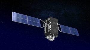
The Asia-Oceania region holds a unique place in the world, being served by several GNSS including Quasi-Zenith Satellite System (QZSS) operated by the Cabinet Office of the Government of Japan, which gives opportunities for the users to benefit from highly reliable applications. The MGA supports the interaction between academia, service providers, and young professionals/students to encourage them to take stock of this potential.
“Asia has the most available satellite signals in the world. Multi-GNSS Asia proposes to tackle societal issues in Asia such as Bangkok’s heavy traffic, Langkawi’s marine pollution,” says Mr Satoshi Kogure, Co-chair of Multi-GNSS Asia / Executive Director of Quasi-Zenith Satellite System. “I don’t want to see horrific images of forest fires and Koalas falling to the ground. I want GNSS to help preserve the beautiful mountains, oceans and diverse wildlife for the generations to come.”
The Japanese Government is currently expanding its 4 satellite GNSS system called QZSS to a 7 satellite system to further contribute to higher accuracy and higher usability for users. Mr Satoshi Kogure hopes this will expedite innovation and bring benefits to citizens and to society as a whole.
As part of its mission to nurture the next generation of innovation in the field and to connect young professionals/students with experts in the field, one of the main activities we host is the Rapid Prototype Development Challenge (RPD Challenge).
What is the RPD Challenge?
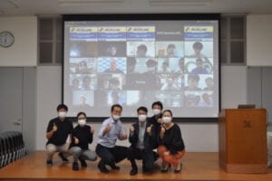
The RPD Challenge is a Hackathon where participating teams come up with creative ideas utilizing GNSS, and with the help of experts in the field, to build a working prototype by the end of the course. In 2020, due to the global pandemic, MGA together with National Space Policy Secretariat, Cabinet Office, the Government of Japan and Geo-Informatics and Space Technology Development Agency (GISTDA) in Thailand co-organized the special online version of RPD Challenge under the theme of ‘Solutions for Disaster Management: Tsunami/Flooding’. The course started by participants to study the online video content made by MGA experts, which then were followed by online workshops for ‘Step 1: Define Scenario’ and ‘Step 2: System Design & Project Planning’ with interaction and guidance from experts from academia and industry. Multiple experts and facilitators engaged with the participants to bring their concept to life. The final demonstration and awards are scheduled to be organized early next year. It’s truly a one-of-a-kind event where participants can not only have the opportunity to develop a concept, but to also be able to engage with one of the best in the field, and to create a working prototype.
All its participants will have the potential to becoming key players in the future, utilizing GNSS, contributing to society, and bringing their innovative prototypes to this massive Asian market.
MGA has been accelerating their online activities with online events and creating online content available to the wider public to support the next generation of professionals with the knowledge they need to reap the benefits of GNSS and expand their network in the Asia- Oceania region.
More online events in the first quarter of 2021 are being planned as we speak. Connect with us on our Facebook page and check out our video content from our YouTube channel!
Facebook: https://www.facebook.com/multignss
YouTube: https://www.youtube.com/channel/UCnRbp4WOfQIYf_vcBFD1CLw/featured


