SpaceWatch.Global An independent perspective on space

by Guy Thomas
SpaceWatch.Global asked its staff and contributors to review 2020 and provide an outlook into 2021. These personal reviews are being published during the holiday season. This is the answer of Guy Thomas, retired signals intelligence officer.
In 2020 Technology took Two Steps Closer to Global Maritime Awareness via Space Systems
2020 saw the advent of the commercial availability of two game-changing technologies in the space-based maritime situational awareness arena. The first, radio frequency geolocation satellites (RFgeoSats), also known as electronic intelligence (ELINT) and signals intelligence (SIGINT) satellites, have generated a good deal of interest in the maritime surveillance business, but the other significant event has gone almost unnoticed. It is the commercial availability of the long anticipated DDR4 SDRAM processor. DDR4 SDRAM is the abbreviation for “double data rate fourth generation synchronous dynamic random-access memory” and the new space-qualified processor promises to provide new capabilities in space.
Both of these technologies will significantly change how space-based maritime situational awareness is conducted, how useful its results will be to the end user, and thus how maritime domain awareness is developed and maintained, globally. We are nearing the ability to provide Global Maritime Awareness via space systems, a personal goal of mine for over 16 years, in the immediate future, probably within five years.
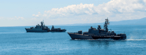
Let’s discuss RFgeosats first. They are a game changer because they will eventually, when paired with the new DDR4 SDRAM processor, allow for the identification of every single radar in the world. That is not that big a deal when discussing land-based systems, but it will be huge when discussing shipborne radar, and the need to understand the “pattern of life” of as many ships as possible for anomaly detection software to function. S-AIS has taught us that the tracking of all ships possible allows for the establishment of this pattern and it is very useful in maritime situational awareness. The more ships tracked and the better fidelity of that tracking should provide a significant increase in this core understand of maritime operations.
Right now, the only way to identify the location and identity of a ship when it is at sea is via satellite AIS (S-AIS). Ships engaged in illegal activity now recognize this fact and often turn off their AIS or at least change its AIS ID to avoid detection. However, ships are very reluctant to turn off their radars as it is a major safety system, especially when near land such as when they are leaving port and returning from sea. This is when the “bad guy” ships will be vulnerable to detection by both the AIS system and the ELINT satellites.
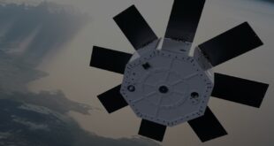
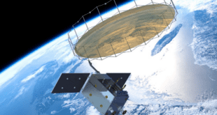
At least two of the ELINT satellite makers, Unseen Labs and Horizon Technologies, (whose Amber satellite will be the first true SIGINT satellite on the open market as it can exploit emitters’ (radar and communications) external signatures as well as the internals of a significant number communications systems, are openly discussing their ability to do “Specific Emitter identification” (SEI), AKA “fingerprinting,” and two other companies who are focused on this technology, Hawkeye360 and KLEOS, may well be developing SEI as well. This capability, coupled with the ability to correlate a radar to a specific ship via AIS when both signals are collected at the same time from the same vessel, will be a boon to the maritime surveillance world.
It will probably take a few years to develop the radar ID data base for all areas of interest, but both Unseen Labs and Horizon Technologies are sure it can be done. Indeed, maritime dynamic data analysis systems such as Computer Assisted Threat Evaluation (CATE), the first system to address this problem using AIS, and Computer Assisted Maritime Threat Evaluation System (CAMTES) which followed about a year later have been cataloging all merchant ships via AIS and S-AIS data for over 15 years now. The ability to process data has come a long way in that period. The inventors of those two groundbreaking systems, Jatin Bains and Paul Kerstanski, respectively, are now collaborating at Space-Eyes as they turn their attention to this challenge. I am sure others are working on this problem as well.
Data processing has taken a big step forward with the introduction of the DDR4. It is the latest version of the SDRAM, the fastest and largest semiconductor technology, DDR4 started development in 2005, even before DDR3 was introduced in 2007. Non-space qualified DDR4 was introduced in 2014, so space-qualified DDR4 processor has been a long time in coming.
SDRAM are organized as a logical array of cells as the basic component of onboard storage. DDR4 has been in development even before the DDR3 was introduced in 2005. According to Dr. Rajan Bedi, the CEO and founder of Spacechips, compared to existing qualified DDR3 SDRAM, the DDR4 provides:
- a 62% increase in memory bandwidth, doubling current transfer speeds,
- a 25% increase in storage capacity, and
- a 76% reduction in physical size.
These capabilities will allow remote sensing satellite makers to substantially increase on-board processing and greatly improve downlink times, a critical need in space-based maritime surveillance. This is especially true when employing synthetic aperture radar satellites for maritime surveillance. SARsats’ day or night, rain or shine capabilities form, along with S-AIS form the bedrock of the space-based maritime awareness business. Any improvement in its capabilities, especially in the area of timeliness has a large impact on its increased utility.
Indeed, the DDR4 may well also allow for the increased utility of video for the surveillance underway ships at sea from space. It will also facilitate on-board artificial intelligence (AI) and machine learning (ML) routines to extract insights to speed the tasking of other collection elements as well as improve the speed and accuracy of reporting events in the maritime regime, two critical requirements. DDR4’s long-anticipated capabilities will be employed to address have a number of new tasks, including the cataloguing of the world’s maritime radars and linking them to specific ships.
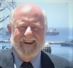
Guy Thomas, the former US’ Science & Technology Advisor for Maritime Domain Awareness, and a retired signals intelligence officer who served with the Navy, Air Force and Coast Guard, is the inventor of satellite AIS and author of the C-SIGMA concept, the basis of Task #1 of the US’ National Space Policy.