
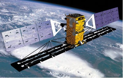
The South African National Space Agency (SANSA) has selected Canadian company MacDonald, Dettwiler and Associates (MDA), a subsidiary of Maxar Technologies, to provide satellite surveillance data from RADARSAT-2 for maritime domain awareness.
This multi-million dollar contract provide SANSA with a one-year maritime surveillance program which will include the delivery of synthetic aperture radar (SAR) data products from the RADARSAT-2 satellite, using MDA’s global network of ground receiving stations. The contract also includes two additional option years.
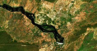
Under this contract, MDA will use RADARSAT-2 information to provide systematic weekly broad-area surveillance over South Africa’s EEZ and on-demand high-resolution image acquisitions. RADARSAT-2 Ocean Surveillance Mode is well suited for broad area maritime surveillance: a single scene covers over 250,000 km2 and allows for the detection of ships and oil within the coastal and offshore regions regardless of light or weather conditions.
“RADARSAT-2 provides a unique method of cost-effectively and accurately monitoring very large areas and providing information in near real-time, demonstrating immediate value to users,” said Mike Greenley, group president of MDA. “MDA has decades of remote sensing expertise to help our customers anticipate and address their most complex mission-critical challenges with confidence.”
SANSA has been tasked to acquire SAR imagery with the aim of enhancing the monitoring and protection of South Africa’s coastal regions and oceans, as part of the Presidential program Operation Phakisa. Initiatives under this program are considered crucial in accelerating the delivery of South Africa’s development priorities.
Operation Phakisa estimates that the approximate total contribution of coastal resources (marine fishing, port and harbour development, attractive lifestyles, recreation and tourism) is 35% of South Africa’s GDP. The information provided by the SAR data contributes to ensuring improved governance and enables the securing of South African resources, such as the National Ocean and Coastal Information System.