By Ralph “Dinz” Dinsley, Executive Director, Northern Space & Security
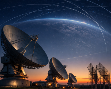
From the timing signal provided by the Global Navigation Satellite System[1] to spectacular photographic observations of changes to our planet,[2] space technology is intertwined in modern society. In addition, countries and corporations alike are becoming aware that a vibrant space economy adds significantly to economic growth and development. Despite the significance of space technology to modern life and the potential of a trillion dollar off-world economy, the fragility of the space environment has largely been ignored in the socio-political mainstream. The majority of people are oblivious to the hazards and threats that six decades of largely unfettered space activity have either created and are encountered on orbit.
There is, within the space community, a recognition of the threat posed by space debris. Yet beyond broad and often fallacious discussions, there appears to be no real understanding of how little we know about the objects that are occupying orbits around the earth. Any discussion on the orbital environment, including threats to future activities must be predicated on a detailed understanding of what is currently happening on the different orbital planes. Without detailed observations on the activity in each orbit, the space community will not able to adequately measure, predict or counter the different challenges that increasing the orbital population will bring.
Space activity is still viewed by the majority of people through the lens of the epic achievements of the Apollo programme. There are many obvious advantages to this, but significantly it helps reinforce traditional stereotypes; of space belonging to an elite group of scientists and explorers. Part of the reason that environmental challenges in space are overlooked in mainstream political discussion is that human space activity is not seen as belonging to everyone. Understanding the threats and dangers from the current behaviours in space requires an appreciation of the science and engineering involved. As the current STEM crisis in schools illustrates; these are not things that people tend to want to engage with.
Coupled with this sense of dispossession is a more practical problem. The threats posed to space are not visible or tangible. Terrestrially, the effects of erosion are visible as cliffs fall in to the sea and the effects of climate change are being experienced in many communities globally. Despite these obvious warning signs, there is alarmingly little consensus on how to stop climate change. If this “head in the sand” mentality happens where people can see and feel the effect, there is little hope of effecting an attitudinal shift when the behaviour is occurring in space, out of the sight and comprehension of the majority of people.
In order to have meaningful discussions on sustainability in space operations the space environment must be made visible and tangible. This can only be accomplished by the sharing of data about space. This, however, exposes another difficulty. Surveillance of space was initially no more than a by-product of missile defence. The military looked into space to discriminate satellites from inbound nuclear ballistic missiles. A re-entering object from space has the same characteristics as an inbound missile. In order to discriminate between the two, the military needed to know where satellites were likely to be and what trajectory they were taking, to ensure we didn’t incorrectly respond to a natural decaying artificial object.
The result of this ballistic missile early warning system capability is that surveillance of objects on orbit has remained firmly in the hands of the military (predominantly the US military) despite the rapid changes in the increased use of space in recent years including the growth of commercial space. The majority of sensors employed to track satellites in Low Earth Orbit are optimised for tracking missiles and there are potentially many more objects in near earth orbit that are missing[3] amongst the broader orbital population.
Estimates from various space agencies as to the location of orbital traffic vary dramatically due to the different simulation models employed. Accordingly, the understanding of that environment is fraught with contradictions. There is no tracking or cataloguing of objects that are not recorded in the published capabilities of the majority of the current sensors employed for space surveillance. Accordingly, simulations have to be developed and this serves merely to obfuscate the debate on what is actually happening in space.
The military space surveillance and tracking mission[4], including support to international and commercial operators, has matured dramatically since the early days of missile warning, especially since the collision of Iridium 33 and COSMOS-2251 in February 2009. National militaries are, fundamentally, tasked with the security and defence of national interests and protecting the future of global space operations [space sustainability] is not a US military task, any more than any other national military.
Despite the willingness for these military personnel to take on the safety of flight mission it is unlikely that defence budgets will ever allocate sufficient funding. Non-military tasks within a defence budget will always lose out to funds being diverted to support other higher priority missions. There is also a broader, cultural issue regarding dissemination of information and data from inside the military to non-military (and in some cases potential adversaries). The use of security classification for information about space presents a fundamental barrier to the kind of data sharing need in order to overcome the deficiencies of information described above.
It is now time for civilian programmes to take the lead on the acquisition and dissemination of information on the orbital environment. There needs to be funding and development of dedicated space surveillance sensors optimised to ensure the maximum amount of data can be obtained. This will allow for a clearer, informed debate about the risks and threats to our critical space infrastructure. At the very least, a civilian-led programme will help plug the information-gap for regulators and policy makers looking to promote sustainable use of space.
The situation is, however, not entirely bleak. Programmes such as the EU Space Surveillance and Tracking (EU SST) Framework provide an example of international civil cooperation adding value to US military support for sustainable space operations. Whilst there is undoubtedly room to develop this, it represents an encouraging start. The initial years of the framework has built upon existing capabilities and in some cases, like the US Space Surveillance Network, repurposed systems designed for ‘other’ tasks in order to support space surveillance.
Ultimately, any discussions on sustainability of space activity need to be based on a clear understanding of the orbital environment. The only way that will be achieved is by a concerted effort of national civilian led space programmes. These programmes must aim to develop dedicated space surveillance sensors designed to meet the current and future hazards and threats in space. Such national programmes need to be anchored in the understanding that no one nation can achieve space sustainability on its own. International collaboration and the sharing of information is central to successful space sustainability. Knowledge is not just power; in the case of space, it should be the basis for every decision that is made.
Ralph “Dinz” Dinsley is the founder and Executive Director of Northern Space and Security Limited (NORSS), an SSA company based in Northumberland, England. A retired RAF Officer with more than 33 years of service he was an “Air Defender” by choice and “Space Surveillance and Tracking Practitioner” by chance. Since retirement Dinz has taken NORSS from a consultancy project to providing unparalleled UK SST expertise supporting government, industry and academic space operations. In partnership with Northumbria University, NORSS is exploring the influence of Space Law on developments for STM through the Space Law Games.
[1] GNSS – GPS, Galileo, Beidou, GLONAST and its regional variants Indian Regional Navigation Satellite System and EGNOS
[2] Of note space has been instrumental in tracking the reduction in pollution since the outbreak of COVID-19.
[3] NASA state ~ 500 000 objects > 1 cm, ESA state ~ 900 000 objects > 1cm
[4] It is estimated that the US DoD spends more than $1B annually on space situational awareness