A University of Tokyo team announced an innovative project to launch approximately 20 microsatellites over the next three years, in collaboration with more than 20 countries, including Laos and Nepal, to supplement existing telecommunications infrastructure.
This marks another development in Japan’s expanding satellite diplomacy across Asia, as it builds influence and capacity while simultaneously countering China’s expanding presence in Asian national space programmes.
This project will improve mobile communications in emerging nations, as well as assist their movement into space and encourage and enhance future demand for satellites and related services.
The team, led by University of Tokyo professor Shinichi Nakasuka, has made a satellite weighing only 3kg, well below the microsatellite classification of 100kg – and less than one thousandth the weight of a conventional satellite. The project will also address a common problem for small satellites: their limited length of time with ground contact while in orbit, by creating a network of roughly 20 satellites circling Earth to ensure unbroken communication.
These small and relatively inexpensive satellites may prompt emerging countries to buy their own microsatellites and motivate them to begin national space efforts. Microsatellites also have relatively short development times — about half that for larger satellites – which may encourage businesses, colleges, and laboratories to explore their own potential.
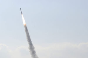
In an early February test, Nakasuka’s team used an SS-520 rocket from the Japan Aerospace Exploration Agency (JAXA) to launch a Tricom-1R microsatellite, known as “Tasuki,” into orbit.
Operating at relatively low costs, microsatellites enable smaller enterprises to enter the space business, which was dominated in the past by governments and large corporations.
In Laos, mobile communication coverage can be spotty, which impedes monitoring efforts. Nakasuka’s satellite network will supplement the existing telecommunications infrastructure, enabling reliable measurement of water levels and temperatures in various locations. The information can be used to monitor flooding and other changes to the environment.


