BDLI - 15th NSBreakfast

#SpaceWatchGL Column: Space-Based Global Maritime Awareness Is A House

Photo by Max Ostwalt on Unsplash.

By Guy Thomas

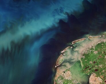
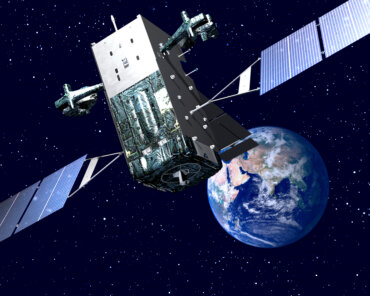
As space-based Global Maritime Awareness has become more and more robust, I have come to think of it as a house, even my home. The latest addition to this house, provided by the new Radio Frequency Geolocation satellites, have finally made this house truly livable.

Let me explain.

Space-based Global Maritime Awareness (GMA) came into reality with the launch of the first S-AIS constellation by ORBCOMM in 2008, but it really was not complete as a system until the launch of unclassified radio frequency (RF) satellites last year. HawkEye 360’s Pathfinder is probably the first RF geolocation satellite: certainly, it is the first anyone is talking about. It has just completed a year in space, living up to all expectations.

This satellite will be the first of many! Kleos will lauch an RF geolocation satellite very soon and Horizon Technologies plans to launch a full SIGINT system, exploitating both radar and communications this summer. The term describing the new satellites is a bit cumbersome. Indeed, I originally called them unclassified ELINT (electronic intelligence) satellites but some folks were uncomfortable with that label, even though Soviet ELINT satellites were discussed and described in many open sources starting in the 1980s — and that is what they are. To be politically correct, I suggest we call them RFgeoSats, but I am open to suggestions. Remember, you saw it here first

It has been recognized for some years that RF geolocation would be a very useful tool for maritime awareness, especially when used in collaboration with S-AIS. It fills a need to track ships when they turn off their AIS, as many bad actors now do when they commence nefarious actions such as smuggling, illegal fishing, or pumping their bilges in restricted waters. But you still need AIS to identify the ships on initial contact, before they turn it off. These two systems, S-AIS and RFgeoSats, are not in competition with each other as some suggest, but, rather, they are complementary, maybe even synergistic. We don’t have enough firm data to be absolutely sure, but initial indications point to it.

Back to the house analogy: S-AIS gives you the base, the foundation locational information for global maritime awareness. It does not give just location, but also name, physical dimensions, last port of call, next port of call, and a great deal more information. AIS, both terrestrial and space-based, is truly the sturdy foundation of Global Maritime Awareness.

RF geolocation satellites are the floor set on that foundation. Heretofore, we had a foundation, but we needed more, we needed a floor to set on top of it. That foundation had its rough spots and could be pretty cold without more data and information to warm it up. The RFgeoSat collection and location of maritime emitters does just that.

They are working on upgrading the processing of these signals to include what we used to call — back when I was an ELINT operator on a cruiser off Vietnam — signal “fingerprinting” to allow us to determine exactly which ship, by name, we were picking up before we could see it coming over the horizon. The identification fingerprinting process became too technically sophisticated to call it simple fingerprinting so they came up with a much more important-sounding, even elegant, term: “Specific Emitter Identification” (SEI).

I’m not sure what the folks at Fort Meade call it today, but the result is the same. I have faith that we will soon, in many cases, be able to determine which specific ship is broadcasting a particular radar or communications signal by the uniqueness of its signal parameters. That information will be a result of the collaboration of S-AIS and RFgeoSats systems. These two systems will be clearly synergistic at that point.

To continue the house analogy, once the foundation is laid and the floor is in place, you can start erecting the walls to give the people in the house maritime awareness — and thus security. Indeed, it is now widely acknowledged that you cannot have maritime security without maritime awareness, and you cannot have effective maritime awareness without space systems as an integral part. These “walls” — a very important part of any structure — are provided by the synthetic aperture radar satellites. SARsats, with their day/night rain or shine capabilities.  Early versions were big guys. I stood next to MDA’s RadarSat 2 just before it was packed up and sent to the launch pad, and I was truly impressed by its size. It was about 47 feet, or 15 meters, tall as I recall.  I am told that ICEYE, one of the newest SARsats, and almost as capable as the previous generation of systems, could fit in the front passenger seat of a Cessna 172, a smallish single engine airplane.

The pattern of “life at sea” — or operations at sea, or whatever you’d like to call it — gleaned from the collection of  S-AIS for the past dozen years plus, and soon to be assisted by the RFgeoSats, greatly assists the SARs to determine where to focus their collection efforts.  By comparing the data collected by these three systems, analysts can detect a great deal of information — including who is trying to avoid detection! The geographic area and history of the vessel trying to avoid detection tells the analysts, now often assisted by AI and machine learning, a great deal.

These three systems, S-AIS, RFgeoSats and SARsats, are a second true synergism. They all strongly complement each other when used in collaboration for maritime awareness. Once the analysts have a handle on their task at hand, they may want to call for the final collection effort: the imaging satellites.

The optical satellites systems, still and video, are the windows of the GMA house.  As when building a real house, once the walls are in place you can start adding windows.

Windows are especially useful to look at specific objects and events. They have unique capabilities to tell the analysts a great deal, but you have to look during daylight to really get the high-resolution pictures often required by analysts. This is an apt analogy because these are the systems we use to see the world as it really is; but, just like windows, they don’t work very well when the lights are out or dimmed. Still, they are very useful under the right circumstances.  While imaging sats can be used for search in known areas of maritime operations, they are most productive when they are aimed at a specific location for a specific purpose.  The analysis which provides that location and purpose comes from the other three systems, S-AIS, RFgeoSats and SARsats.

The Global Maritime Awareness house is decorated with many types of information — in all sizes and shapes — from many sources, including The International Maritime Organization’s (IMO) Long Range Identification (LRIT) and the Vessel Monitoring System (VMS) of the world’s fishing fleets, shipping records, police and other law enforcement records, ship builders, brokers, and financial records.  It is a very eclectic collection, but nearly all of it is extremely useful at one time or another.

The roof of our GMA house is dual purpose. It both collects and protects the house and its decorations: stacks of the myriad sources of information available on maritime operations both at sea and in the marine support system on land. This over-arching roof is made up of many different dynamic data analysis (DDA) tools, now routinely incorporating machine learning and AI. These DDA tools are supplied by many different entities, including nearly everyone who builds an Earth observation spacecraft.  E-GEOS’s Smart Eyes on the Seas (SEonSE) and CLS’ Maritime Awareness System (MAS), as well as the similar tools by AirbBus and MDA. These are just a few of several such tools.

However, there are also stand-alone DDA efforts out there. These dynamic data analysis tools are, just like a roof in a real house: a crucial part of the structure. They are necessary to take the derived and accumulated data and develop information, then understanding, and finally wisdom from the data collected with the system I’ve just described.

The DDA tools have come a long way from Channel Logistics’ Computer Assisted Threat Evaluation (CATE) tool of 2004 and Greenline’s Computer Analysis Maritime Threat Evaluation System (CAMTES) from about 2 years later. Jatin Bains of Channel Logistics and his competitor, Paul Kerstanski of Greenline, were the pioneers in this field and to this day they both continue to upgrade their tools’ capabilities. For example, Channel Logistics, now doing business as Space-Eyes, is revolutionizing collections further by co-locating SAR and AIS payloads on the same spacecraft with a 400 km swath. The small satellite revolution will enable tactical ISR collections over the maritime domain; however, analytics and insight at the speed of relevance remains the Holy Grail.

Windward, a Tel-Aviv based maritime analytics company headed by Ami Daniel, took DDA to a whole new level by being the first that I know of to fully introduce AI to exploit maritime data in innovative ways. They provide insights to many organizations in the maritime ecosystem, including governments, insurers, financial institutions, and energy companies, enabling them to optimize their performance and stay ahead of the adversaries to good order in the maritime domain.

Similarly, David Waldrop developed a DDA tool for the classified elements of the US government, but he now has permission to sell some parts of it in the commercial world. I have seen his brief, and it is very impressive, but I have no real idea who has the best system today.

Because I no longer work for the US government, I no longer have open access to the inner workings of these tools. However, I have been involved in the computer fusion and analysis of both like and dissimilar data since the early 1980s, and I can tell that all four of these men are very intelligent and highly dedicated to their craft. I feel fortunate to be just smart enough to understand how smart they are.

—– —– —–

This is the house I have been helping to build since October 2001, and I am very proud of the space-based Global Maritime Awareness house.

Indeed, the world space community keeps upgrading it with more and better systems which are also becoming more and more robust.

The foundation is pretty well set, what with three major players, ORBCOMM, ExactEarth/Harris, and Spire competing to build better and better S-AIS based data bases and support feeds.

The walls were looking better and better as MDA, DLR/Airbus and E-GEOS came on-line and then others, including ICEYE and SSTL’s NovaSAR, and soon Capella (of which big things are projected). These SARsats, from all over the world are making a large into this house, and it is becoming more and more useful in the maritime domain.

The number of optical systems on orbit today, led by Planet and MAXAR, is mind boggling to most of us. This GMA house now has many windows and doors, and more are being installed on a seemingly monthly basis.

The floor always needed improvement. Now that Hawkeye 360 is up and operating, and KLEOS and Horizon Technologies, plus others, are on the edge — ready to join the maritime awareness house — the flooring is getting stronger and stronger, and better looking, too. I predict that the RFgeoSat floor, which is basically unknown in many parts of the world, will soon have a shine, a luster to it, just like a new floor does. That is exactly what happened to S-AIS: in the space of two years, 2008-2010, S-AIS went from unknown to a “must have.” I predict the same will happen to the RFgeoSats

I have been part of the global team building this Global Maritime Awareness house for over eighteen years, and I can see that it will be a mansion soon. I am also sure that if I were to come back 18 years from today, I would not even recognize it – just as Orville and Wilbur Wright would not recognize a 747, an A-380, or an F-35 if they were to come back today.

Just like them, I had no idea exactly what I was helping to create, but we saw a need and dedicated our lives to making this dream house happen.

If you think this was written to be a primer for space-based Global Maritime Awareness, you are exactly right!

Cheers,

Guy

Guy Thomas is Contributing Editor for Maritime and Military Affairs at SpaceWatch.Global. 

Check Also

Matevž Frangež, State Secretary, Ministry of Economy, Tourism, and Sport signs the Artemis Accords on behalf of Slovenia with NASA astronaut Randy Bresnik, Ambassador Jamie L. Harpootlian, Rebecca Bresnik, Associate General Counsel for International and Space Law, and Slovenian Ambassador to the United States Iztok Mirošič standing behind.

Slovenia Joins Artemis Accords as 39th Signatory

Slovenia has become the 39th Signatory to the Artemis Accords after it and NASA affirmed their cooperation in future space endeavors on Friday. The signing certified Slovenia’s commitment to pursue safe and sustainable exploration of space for the benefit of humanity and took place during a U.S.-Slovenia strategic dialogue in Ljubljana, Slovenia, at the Ministry of Foreign Affairs Offices.