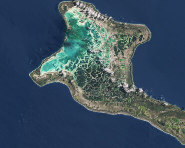
Glex Summit 2024 - Banner

JAXA To Provide Satellite Imagery To Support UN Food And Agriculture Organisation Forestry Land-Use Assessments

Imai Ryoichi, JAXA Vice President (left), and Daniel Gustafson, UN Food and Agriculture Organisation’s Deputy Director-General (right), after signing the Memorandum of Understanding on 23 January 2020. Photograph courtesy of JAXA.

The UN’s Food and Agriculture Organisation (FAO) will bolster the scale and scope of its geospatial monitoring toolkit thanks to collaboration with the Japan Aerospace Exploration Agency (JAXA) that will expand the capacity of FAO’s accessible platforms for forestry and land-use assessments.

A three-year agreement signed last week will enhance the access of FAO member states and other users to JAXA data sets and more “ground-truthing” evidence through FAO’s forest monitoring platforms.

“As deforestation and land-use changes are one of the leading sources of global carbon emissions, satellite-based information has a critical role to play in supporting countries to achieve their commitments on climate change,” said Daniel Gustafson, FAO’s Deputy Director-General for Programmes, who signed the agreement in Tsukuba.

Technically, the new collaboration will expand the scope and usability of FAO platforms such as SEPAL and the Global Forest Resources Assessment Remote Sensing Survey, while also boosting the granular accuracy of JAXA-led initiatives that cover the world’s mangroves as well as forestry and land-use themes in general.

JAXA uses L-band Synthetic Aperture Radar (SAR) technology which has a unique feature of being able to observe the Earth’s land surface regardless of time (day and night) and weather (rains and clouds) with waves with especially long wavelengths, allowing to accumulate both vegetation and ground information.

“Over 20 years, JAXA has accumulated global L-band SAR data, which is essential to understand changes in forests and predict their future. JAXA expects our satellite data to be used to support sound decision-making,” said JAXA Vice President Imai Ryoichi, noting that the application of L-band SAR data would be further required in a variety of areas to tackle global agenda and that JAXA stands ready to contribute in remote sensing areas.

Next Steps

Along with offering reciprocal access to select data, FAO and JAXA will conduct training workshops for FAO member states and integrate the data FAO’s Open Foris platform.

FAO’s geospatial toolkit, including SEPAL – the System for Earth Observation Data Access, Processing and Analysis for Land Monitoring now has more than 4,300 active users from 160 countries- offers anyone easy-to-use access to satellite data and supercomputing power, allowing them to create critical forest and land cover information in their efforts to mitigate and adapt to climate change.

The SEPAL platform is built on collaboration and partnerships, and JAXA joins Google, NASA, ESA, Planet, and the World Bank as contributors to the platform. The SEPAL project is funded by Norway’s International Climate and Forest Initiative (NICFI).

FAO expects the collaboration will benefit its ongoing work on forest, peatland and mangrove monitoring and assessment, areas in which JAXA initiatives including the Global Mangrove Watch and JJ-Fast – a forest early warning system in the tropics set up by JAXA and the Japan International Cooperation Agency (JICA) are highly valued contributions.

“This is the kind of partnership that smartly leverages skills and resources to boost our knowledge base and potential impact,” said Hiroto Mitsugi, FAO Assistant-Director-General of the Forestry Department.

Check Also

OroraTech

OroraTech Selected as One of XPRIZE’s Top 20 Finalists

In a significant step toward leveraging technology to combat wildfires, OroraTech has announced the XPRIZE Foundation has selected it as one of 20 finalists in the prestigious XPRIZE Wildfire Competition in the Space-Based Wildfire Detection & Intelligence track, moving on to the final round of the competition.