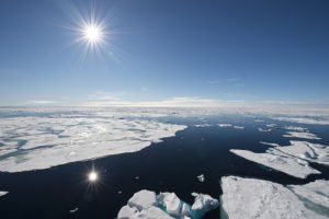
The U.S. National Geospatial-Intelligence Agency (NGA) awarded GeoNorth Information Systems (GNIS) a five-year, U.S.$15 million contract for persistent surveillance services of the Arctic region. Lockheed Martin will provide a scalable geospatial processing platform to enable the surveillance project.
GNIS will leverage Lockheed Martin’s Rosetta technology, which includes a versatile and highly automated set of commercial and civil image processing tools that scale and adapt to deliver precision geospatial intelligence products to the NGA.
GNIS, a wholly owned subsidiary of the Tatitlek Corporation, an Alaska Native Village Corporation, will work with Lockheed Martin and the University of Alaska Fairbanks’ (UAF) Alaska Satellite Facility (ASF), under the banner of the Arctic GeoData Cooperative. GNIS and the partners will build, improve, monitor and maintain terrain elevation models of the Arctic region.
“The Arctic region has significant global implications for environmental, economic and security factors,” said Gil Metzger, director of Applied Research at Lockheed Martin.
“It is critical that we document and monitor this demanding environment with the best technologies available. Lockheed Martin is proud to be part of this innovative Cooperative that establishes both an operational domain awareness capability and a foundation for advanced research.”
The cooperative team will leverage each member’s unique expertise and capabilities to provide a one-of-a-kind solution to partners like the NGA.
“The Arctic domain poses many challenges,” said Jon Heinsius, general manager of GNIS.
“Not only is it an area much larger than the whole United States and Canada combined, but its remoteness, intense weather conditions and unique characteristics are not found anywhere else in the world. The Cooperative’s combined academic and commercial approach provides the NGA with tremendous flexibility to meet their current and future needs.”
As the prime contractor, GNIS will perform overall project management, conduct day-to-day operations and provide access to commercial remote-sensing platforms through its existing direct receiving station located at ASF. UAF brings broad Arctic-related research and development, problem solving and the ability to refine existing scientific algorithms and methods to support specific project requirements. Lockheed Martin’s Rosetta tool-set will transform the large volumes of sensed data into correlated geospatial intelligence products.
“The Cooperative is going to be a supportive environment where participants can bring ideas, technologies, algorithms and research for development, testing and validation,” said Dr. Nettie La Belle-Hamer, director of the Alaska Satellite Facility.
“The concept is to explore and nurture new ideas to take what we learn today to build for tomorrow.”
 SpaceWatch.Global An independent perspective on space


