John Sheldon
June 6, 2017
News, Public Content, Space Economy News, Space for Earth News
Harris Geospatial is incredibly excited to officially launch its new membership to Planet’s Application Developer Programme! As part of this program, ENvironment for Visualizing Images (ENVI) algorithms and Planet data work in tandem to bring best-in-class analytics together with multi-temporal high quality imagery, delivering robust end-to-end solutions that solve the …
Read More »
John Sheldon
June 6, 2017
News, Public Content, Space Economy News, Space for Earth News
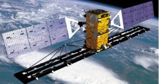
MacDonald, Dettwiler and Associates, Ltd. (MDA), a global communications and information company, today announced that it has signed an agreement to enable access to RADARSAT-2 archive data on GBDX, the powerful Geospatial Big Data platform of DigitalGlobe, Inc. GBDX is a leading platform for processing and analyzing geospatial data; it allows …
Read More »
John Sheldon
June 6, 2017
News, Public Content, Space, Space Economy News
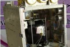
A group of fifteen Jordanian students from several universities have built a Cubesat to be launched in early 2018, under the sponsorship of the Masar Initiative, part of Jordanian Crown Prince Hussein’s Crown Prince Foundation (CPF). The students were supervised by Jordanian engineering and science academics at the Royal Jordanian …
Read More »
John Sheldon
June 5, 2017
News, Public Content, Space Economy News, Space for Earth News
Airbus Defence and Space has launched the “Global Earth Observation Challenge”, encouraging start-ups worldwide to innovate and develop new applications primarily based on Airbus satellite data. These creative ideas are designed to bring new developments of Earth observation services, as well as ground-breaking solutions. The goal of this 4-month challenge …
Read More »
John Sheldon
June 5, 2017
Geopolitics News, News, Public Content, Space, Space Economy News
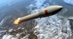
Roketsan, one of Turkey’s leading company’s in the aerospace industry, have recently announced their plans going forward with the Turkish Satellite Launch System (SLS) project they signed with the Turkish government in 2013. A Rocketsan press release that came out right before the Turkish International Defence Industry Fair held May …
Read More »
Torsten Kriening
June 4, 2017
News, Public Content, Space, Space Economy News, SpaceWatch.Global Opinion
Patrick Gannon, Director of Business Development at BusinessCom Networks, has been involved in data communications and networking since early modems were as big as shoeboxes and cost a dollar per bit. He has deployed a wide variety of networking technologies for leading technology developers, over the last three decades, from …
Read More »
John Sheldon
June 2, 2017
Geopolitics News, News, Public Content, Space, Space Economy News
In an unsurprising move, the Iranian government has officially abandoned Tehran’s ambitions to send humans into space. According to Iranian news agency ILNA, Mohammad Homayoun Sadr, the deputy head of the Iran Space Agency (ISA), made the announcement citing the extremely steep cost of a human spaceflight programme that he …
Read More »
John Sheldon
June 1, 2017
News, Public Content, Space Economy News
Europasat, the Inmarsat S-band/HellasSat-3 telecommunication satellite, has been shipped to the Kourou launch pad in French Guyana to be launched by Ariane 5 rocket in June. This condominium satellite for Inmarsat and HellasSat will provide Mobile Satellite Services (MSS), Fixed Satellite Services (FSS) and Broadcast Satellite Services (BSS). The payload …
Read More »
John Sheldon
May 31, 2017
News, Public Content, Space Economy News, Space for Earth News
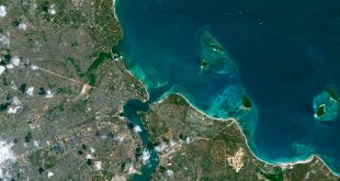
Airbus Defence and Space expands its WorldDEM portfolio with the launch of the “WorldDEM Ocean Shoreline” product. Developed in cooperation with the Center for Southeastern Tropical Advanced Remote Sensing (CSTARS) at the University of Miami in the United States, this new thematic layer provides highly detailed and accurate shoreline mapping …
Read More »
John Sheldon
May 31, 2017
Geopolitics News, News, Public Content, Space, Space Economy News, Space for Earth News
Iranian press reports suggest that Iran is preparing a third satellite for launch within the next 12-18 months. The satellite in question is called Soha, a remote sensing satellite believed to have a resolution of 15 metres. According to the Islamic Republic News Agency (IRNA), the head of the Iran …
Read More »
 SpaceWatch.Global An independent perspective on space