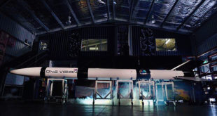
Australian rocket company, Gilmour Space Technologies, has unveiled its ‘One Vision’ rocket which it plans to launch later this month, and conducted a live demonstration of its automated mobile launcher, the first of its kind in Australia.
Read More »France And The UAE Discuss Hyperspectral, Space Exploration Cooperation Plans
The head of the French national space agency, the Centre national d'études spatiales (CNES), Jean-Yves Le Gall, took part in the World Government Summit in Dubai, UAE, on 11 February 2019 where he met Dr. Mohammed Al Ahbabi, Director General of the United Arab Emirates Space Agency (UAESA), and Yousuf Hamad Al Shaibani, Director General of the Mohammed Bin Rashid Space Centre (MBRSC).
Read More »Maritime Domain Awareness: exactEarth’s Orbital Maritime Tracking System Fully Deployed
exactEarth Ltd. reports that the final six payloads for its second-generation constellation, exactView RT, are now operational, which completes the roll-out of world's first global, real-time Satellite-AIS service.
Read More »Australia And UAE Space Agencies Sign Partnership MoU In Adelaide
The Australian Space Agency (ASA) has entered into a Memorandum of Understanding (MoU) with the United Arab Emirates Space Agency, facilitating closer international partnerships in the space industry sectors.
Read More »Israel’s Gilat To Provide Satellite Broadband Solution For India’s GSAT-11
Gilat Satellite Networks Ltd., a worldwide leader in satellite networking technology, solutions and services, has announced that it was awarded a multi-year contract to provide equipment and services for broadband connectivity over ISRO’s GSAT-11 across India.
Read More »Israel’s Gilat Posts Strong Q4 2018 Financial Results; Reports Strong Profits and Growth
Gilat Satellite Networks Ltd., a worldwide leader in satellite networking technology, solutions and services, today reported its results for the fourth quarter and full year ended 31 December 2018.
Read More »Equatorial Launch Australia Inks Deal With US Customer
Australia’s first commercial spaceport, Equatorial Launch Australia (ELA), has announced that it has inked a contract with U.S.-based TriSept Corporation, that offers launch integration services, rideshare and dedicated missions to small satellite customers. This agreement will see ELA provide an efficient launch and recovery location for the fast-growing commercial satellite and rocket launch market which is poised to pass U.S.$2.4 billion in 2024.
Read More »UAE University Students Focus On Greenhouse Gases With New Satellite Project
A nanosatellite named MeznSat is being manufactured by a group of university students in the UAE, the Khaleej Times has reported. The aim of the satellite is to pinpoint the cause of greenhouse gases. Once the data from the satellite is shared with students, analysts and researchers, it is hoped that they can work to mitigate the production of the gases. The students, from the American University of Ras Al Khaimah (AURAK) and the Khalifa University, aim to launch the satellite later this year.
Read More »Israel’s Gilat Demonstrates Maritime Connectivity On Telesat’s Phase One LEO Satellite
Gilat Satellite Networks Ltd., a worldwide leader in satellite networking technology, solutions and services, announced on 6 February 2019 the completion of a successful test with a tier-1 maritime service provider for maritime communication over Telesat’s low earth orbit Phase 1 LEO satellite. This industry-first milestone exemplified exceptionally low latency and high bit-rate essential for multiple maritime applications.
Read More »5G And Satellites: Israel’s Gilat Announces 5G-Ready Satellite Backhaul Solution
Gilat Satellite Networks Ltd., a worldwide leader in satellite networking technology, solutions and services, has announced the launch of a new powerful backhaul solution designed to deliver the high-performance required for next-generation services.
Read More » SpaceWatch.Global An independent perspective on space


