John Sheldon
June 12, 2017
Geopolitics News, News, Public Content, Space, Space Economy News
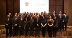
Under the patronage of the Ministry of Foreign Affairs and International Cooperation of the United Arab Emirates, UAE-based satellite operator, Yahsat and the UAE Permanent Mission to the United Nations Office and other International Organizations in Geneva, hosted a one-day forum in Geneva, to discuss Yahsat’s initiative to support humanitarian …
Read More »
John Sheldon
June 12, 2017
News, Public Content, Space Economy News
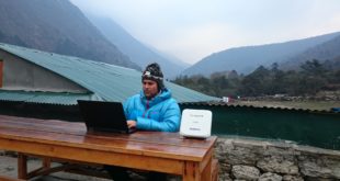
Thuraya recently worked with service partners, Talia and NBS Maritime, to sponsor and support two climbers – Holly Budge and Dr. Atanas Skatov – in their summit expeditions to Mount Everest. Both Ms. Budge and Dr. Skatov completed their missions successfully and were able to stay connected with wireless data …
Read More »
John Sheldon
June 9, 2017
News, Public Content, Space Economy News, Space for Earth News
British satellite company Earth-i has announced that it has joined the USGIF (United States GeoSpatial Intelligence Forum) and will be expanding its operations in the US. The company already has a number of customers in the US and is in discussions with other high-profile potential partners and customers across North America. …
Read More »
John Sheldon
June 9, 2017
Geopolitics News, News, Public Content, Space, Space Economy News, Space for Earth News
Iran and the Eurasian Economic Union (EAEU) are close to cementing a free trade deal that would see Tehran join the trade bloc built around former Soviet republics by the end of 2017. Once this happens, Iran will also be poised to participate in the EAEU’s nascent space activities. The …
Read More »
John Sheldon
June 8, 2017
Geopolitics News, News, Public Content, Space Economy News, Space for Earth News
While the Copernicus Sentinel-3A satellite is in orbit delivering a wealth of information about our home planet, engineers are putting its twin, Sentinel-3B, through a series of vigorous tests before it is shipped to the launch site next year. The Sentinel-3 mission is designed as a two-satellite constellation to give …
Read More »
John Sheldon
June 8, 2017
News, Public Content, Space Economy News
Hughes Network Systems, LLC, the global leader in broadband satellite solutions and services, has announced that its JUPITER™ System has been selected by Global-IP Cayman as the technology platform to enable its mission of bringing high-performance connectivity to mobile devices used throughout the Sub-Saharan Africa region. The JUPITER System will …
Read More »
John Sheldon
June 7, 2017
Geopolitics News, News, Public Content, Space Economy News, Space for Earth News
Harris Corporation’s first four maritime vessel tracking receivers are now operational – establishing the beginning of the only global, persistent, real-time Automatic Identification System (AIS) ship tracking capability. Launched January 14, 2017, onboard four Iridium NEXT satellites, the maritime tracking hosted payloads are now tracking 250,000 ships and providing data …
Read More »
John Sheldon
June 7, 2017
Geopolitics News, News, Public Content, Space Economy News, Space for Earth News
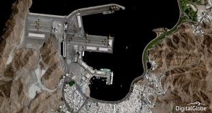
DigitalGlobe, Inc., the global leader in Earth imagery and information about our changing planet, has announced it will launch a premium monitoring service, SecureWatch Sites, which provides current satellite images of high-interest, global locations on a regular basis from multiple commercial providers. SecureWatch Sites imagery is made available through the …
Read More »
John Sheldon
June 7, 2017
Geopolitics News, News, Public Content, Space Economy News
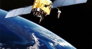
China and Middle Eastern states are working together to promote the use of China’s Beidou Navigation Satellite System in the region, according to a statement following an industry forum on May 24, 2017. All parties concerned have pledged to strengthen their communication and collaboration in satellite navigation and to bring …
Read More »
John Sheldon
June 6, 2017
News, Public Content, Space Economy News, Space for Earth News
Harris Geospatial is incredibly excited to officially launch its new membership to Planet’s Application Developer Programme! As part of this program, ENvironment for Visualizing Images (ENVI) algorithms and Planet data work in tandem to bring best-in-class analytics together with multi-temporal high quality imagery, delivering robust end-to-end solutions that solve the …
Read More »
 SpaceWatch.Global An independent perspective on space