SpaceWatch.Global An independent perspective on space

by Malak Trabelsi Loeb
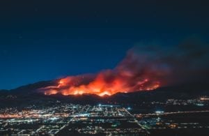
The recent 2020 US West Coast wildfire has opened infernos, as it ravaged hundreds of homes and charred hundreds of neighborhoods. On September 10, 2020, CNN announced that the Creek Fire had taken more than 166,00 acres after destroying 360 structures in Central California, Amidst a state emergency, firefighters had to defeat the “beast” that turned the scenery to a similar fiction movies scene on a doomsday. Wildfire causes environmental disasters that were attributed by many scientists to climate change. The preparedness, detection, and management of wildfires and other environmental disasters, that affected the environment hinge on satellite technologies, essentially, the Remote Sensing of sea surfaces and land areas, and the civil space-based Earth Observation and its applications. Such space-based technologies are deployed to assess, monitor, and manage local, regional, and large-scale transboundary environmental issues that impact the societies, economies, and ecosystems. Thanks to its large areas’ data collection and high-frequency capabilities, Earth Observation, in particular, has become a powerful tool to monitor the terrestrial environment and manage environmental disasters as it will be addressed in this article.
Satellite technologies have been used to understand climate change better to find solutions to mitigate its deteriorating consequences, such as hurricanes, droughts, rising sea levels, melting polar ice caps, wildfire, and floods. Scientists relied upon various observation systems and satellite technologies, networks of weather balloons, buoys, and thermometer, to collect climate change’s evidence from the depths of the oceans to the top of Earth’s atmosphere. For instance, EO is relied upon to map the greenhouse gases. Earth Observation (EO) monitors the carbon dioxide (CO2) concentration, the second most abundant greenhouse gas component after water vapor, satellite monitored through water management, and weather forecast [1]. Public and private entities harnessed spectroscopy and satellites to monitor externalities data from various sources.
Space agencies play a crucial role in monitoring greenhouse gases’ evolution. Taking the example of the Japanese Aerospace Exploration Agency (JAXA) initiative in 2009, the agency has launched the first dedicated satellite, “Greenhouse Gases Observation Satellite” (GOSAT), to measure the CO2 atmospheric level and to monitor the global greenhouse gases concentration [2]. When it comes to monitoring greenhouse gases, the stakeholders do not make it for the sake of collecting data; instead, they use the precise atmospheric CO2 space-based measurements to mitigate risks of the advert effects of human activities on the CO2 emissions. The collected data shape national and international environmental policies to mitigate risks related to global warming risks [3].
Simultaneously, competent national authorities and non-governmental actors use the collected data to design adequate environmental disasters’ preparedness and management strategies shaped upon various environmental risk assessment models. These models rely upon satellite-based applications – combined with other technologies such as the Machine Learning algorithm – to prepare responsive and reconstructive plans. Every environmental disaster management plan is shaped based on many factors, such as the population’s vulnerability, the area’s associated hazardous risks, and the overall exposure to climate change. Various newly developed applications use high-resolution multispectral and panchromatic satellites, drones and aircrafts’ imagery, and other data harvested from different sources like census data, social media, and surveys, to name a few.
The preparedness and management of environmental disasters rely upon well-defined actions. While disaster management relies on the timely response, accuracy, and joint efforts of the stakeholders, preparedness relies upon the ex-ante measures to mitigate the disaster’s effects [4]. In both cases, satellite technologies are harnessed to assess the potential risks of environmental disasters, prevent them from occurring. They are also utilized to minimize their impact on the affected nations and mitigate their deteriorating effects on human lives, societies, economies, and the environment. Thus, private and public actors collaborate to manage environmental disasters to timely allocate, assess, contain, and mitigate these disasters. One of the most critical frameworks that play a fundamental role in availing satellite technologies to manage disasters is “The International Charter Space and Major Disasters” (the Charter). Members of the Charter agreed in 2000, voluntarily, to join efforts and resources under an international humanitarian collaboration to enable satellite data to respond to disasters rapidly [5]. The Charter’s activation starts when a competent authority of a country by which its space agency is a Charter’s member. The authorized users are granted the right to activate the Charter for non-members too. However, in order to ensure a timely action to manage the disaster, the United Nations Institute for Training and Research’s UNOSAT, the United Nations Office For Outer Space Affairs (UNOOSA), and Sentinel Asia’s users are authorized on behalf of the United Nations Agencies to activate the Charter upon large-scale disasters.
Furthermore, starting in 2012, the Charter has become accessible to any disaster management’s authority to become a member based on the universal access principle [6]. Nonetheless, the Charter can be activated if the disaster is of a technological or natural origin, which occurred within less than ten days. The disaster must fit under the Charter’s application, which requires that the disaster is a compelling sudden event or situation with the potential risk of having a significant impact on lives, infrastructure, and the environment is the primary condition of the Charter activation. Once the request falls under the Charter’s scope, an immediate acquisition plan is made to design an observation[7]. The harvested data is transmitted to the analysts for a quick response. The process depicting the series of events to be conducted under the Charter are illustrated in the following chart [8].
![]() The International Charter Space and Major Disasters, How the Charter Works, Activating The Charter. <https://disasterscharter.org/web/guest/about-the-charter>. (Accessed on August 31, 2020).
The International Charter Space and Major Disasters, How the Charter Works, Activating The Charter. <https://disasterscharter.org/web/guest/about-the-charter>. (Accessed on August 31, 2020).
Once the disaster occurs and the Charter is activated, the chain of actions, under this international humanitarian collaboration, starts when the authorized user acts and that shows from the bottom left side of the illustration. It continues in a clockwise rotation.
The collaboration set in the form of an international consortium of satellite operators and space agencies under the Charter has proven its success demonstrating the crucial role of satellite-based response to disaster management. The Charter’s official website indicates that as of August 29, 2020, the Charter was activated 672 times, with 61 contributing satellites. The Charter served to assist the disaster management’s community in various environmental disasters like the tsunami in Thailand and Indonesia (2004), the snow disaster in China (2010), floods in Germany (2013), fire in Chile (2017), earthquake in Philippine (2020), and the most recent oil spill in Mauritius (2020) [9]. In addition to space agencies, approved national and regional disaster monitoring organizations co-operate under the Charter to assist affected nations by major disasters. For instance, private space actors’ input would play an integral role in the process. In fact, due to the paradigm shift in space exploration due to the rise of the New Space era, private actors would not only contribute to space economic growth, but they could enable access to advanced EO for community preparedness activities which fits under the Charter’s scope of application as previously discussed. Through cost-effective satellite technologies and their related application, private actors could assist countries that lack adequate satellite capabilities. The free access to EO companies’ space technologies under humanitarian assistance is critical to manage environmental disasters and serve in the disaster’s preparedness. This approach could assist populations in isolated, remote, or mountainous areas that lack the terrestrial network to monitor environmental risks and offer Information Communication Technologies (ICT), which are essential in the preparedness of environmental risks and natural management disasters. Taking the example of “Planet,” the satellite operator has been availing Earth-imaging data to assist the Charter since May 2018. “Planet” assistance is recognized to be valuable due to the Charter’s access to more than 150 satellites and their technological capabilities such a high imagery resolution. The first deployment of Planet satellite capabilities was immediately after its admission to the Charter. The private actor has submitted its satellites’ data to the Charter activation to manage the recent floods in Laos and japan [12].
Satellite-based technologies play an essential role in managing environmental disasters and mitigating climate change effects on the environment and Earth’s ecosystems. Their applications have been used to solve other cross-border challenges, such as pandemics. Nonetheless, satellite technologies’ efficiency in managing disasters relies upon the timely response and the joint efforts of public authorities and Non-governmental organizations – with the humanitarian assistance of the private sector.
REFERECES
[1] Parkinson, Claire L., Satellite Contributions To Climate Change Studies, Proceedings Of The American Philosophical Society (PAPS) 161:3 (2017):208-225.
[2] Onoda, Masami, and Oran.R. Young. 2017. «Satellite Earth Observations in Environmental Problem-Solving.» In Onoda, Masami, and Oran.R, ed., Satellite Earth Observations and Their Impact on Society and Policy. 2017: Springer, Singapore, p8.
[3] Onoda, Masami, and Oran.R. Young. 2017. «Satellite Earth Observations in Environmental Problem-Solving.» In Onoda, Masami, and Oran.R, ed., Satellite Earth Observations and Their Impact on Society and Policy. 2017: Springer, Singapore, p8.
[4] Barton, C. Charles, Disaster Preparedness and Management, Information Resources in Toxicology (IRT) (2009): 195-201.
[5] UNOOSA, UN-Spider, Knowledge Portal, Space-Based Information For Disaster Management and Emergency Response: The International Charter Space and Major Disasters, UNOOSA, 2019. <http://www.un-spider.org/space-application/emergency-mechanisms/international-charter-space-and-major-disasters>. (Accessed on March 19, 2020).
[6] UNOOSA, UN-Spider, Knowledge Portal, Space-Based Information For Disaster Management and Emergency Response: The International Charter Space and Major Disasters, UNOOSA, 2019. <http://www.un-spider.org/space-application/emergency-mechanisms/international-charter-space-and-major-disasters>. (Accessed on March 19, 2020).
[7] Courteille, Jean-Claude, International Charter for Space and Major Disasters Space and Major Disasters’ Space-Based Information in Support of Relief Efforts After Major Disasters’, UNOOSA, 2015. <https://www.unoosa.org/pdf/pres/stsc2015/tech-56E.pdf>. (Accessed on March 19, 2020).
[8] Voigt, Stefan, Fabio Giulio-Tonolo, Josh Lyons, Jan Kučera, Brenda Jones, et al., Global Trends In Satellite-Based Emergency Mapping, Science Journal (SJ) 353:6296 (2016): 247–252.
[9] The International Charter Space and Major Disasters, About The Charter. <https://disasterscharter.org/web/guest/about-the-charter>. (Accessed on August 29, 2020).
[10] Voigt, Stefan, Fabio Giulio-Tonolo, Josh Lyons, Jan Kučera, Brenda Jones, et al., Global Trends In Satellite-Based Emergency Mapping, Science Journal (SJ) 353:6296 (2016): 247–252.
[11] Kaku, Kazuya, Satellite remote sensing for disaster management support: A holistic and staged approach based on case studies in Sentinel Asia, International Journal of Disaster Risk Reduction (IJDRR) 33 (2019):417-432.
[12] The International Charter Space and Major Disasters, News: Planet becomes official contributor to the International Charter Space and Major Disasters, August 9, 2018. <https://disasterscharter.org/web/guest/-/planet-becomes-official-contributor-to-the-international-charter-space-and-major-disasters>. (Accessed on August 31, 2020).

Malak Trabelsi Loeb: Senior legal associate specializing in International Business Law and International Space Law, Adjudicator, International Commercial Arbitrator. Entrepreneur, futurist, and strategist. Mrs. Loeb is a Lecturer in International Relations and Diplomacy, a multidisciplinary academic researcher, a writer and public speaker, and a Ph.D. Candidate in International Space Law. She is advocating for Sustainable Space For Humanity, addressing the complex Space socioeconomic and environmental interrelated dimensions. She is a human rights activist and strives to combat human trafficking and gender inequality. Mrs. Loeb has received the title of Champion of Tolerance from the UAE Ministry of Tolerance in 2018.