
by Guy Thomas, Contributing Editor
The US Naval Intelligence Maritime Intelligence Integration Office (NMIO) recently hosted a virtual meeting sponsored by NATO ACT (Allied Command Transformation) on tools being used to combat illegal, unreported and unregulated fishing (IUU). It was heartening to learn of the tools and processes that are being used, and the new ones in development, to combat this global scourge. We are on the right vector to build a Global Maritime Awareness system which will include major inputs from unclassified Earth observation space systems.
At the end, in order to add impetus to the many efforts underway it was offered to provide the words for the US’ National Space Policy Implementation Task #1 which orders the US to build just the system they were describing as needed to be built. Since 2005 that system has been called C-SIGMA (Collaboration in Space for International Global Maritime Awareness).
As several folks alluded to during the NMIO/NATO-ACT meeting, commercial Earth observation satellite data is not free, but as was pointed out in a previous article on space-based Maritime Situational Awareness (MSA) in SpaceWatch.Global, there is only a finite set of types of satellites needed to build an excellent space-based MSA system to dramatically improve the transparency of what is happening on the world’s oceans and seas. This transparency will greatly assist in addressing such problems as IUU, pollution of the maritime environment, smuggling of all types, and sanctions avoidance. Safety at sea will also be substantially improved.
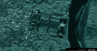
The tidal wave of new Earth observation satellites has placed us on the cusp of having all the capabilities we need, and it is widely anticipated there is going to be a significant lowering of the costs, as launch and operational costs go down and providers increase e. g. there are now three companies supplying satellite Automatic Identification System (S-AIS), ORBCOMM, Harris/exactEarth and Spire and, within the next few years at least three companies, Iceye, Capella and PredaSAR, will have significant constellations of very capable SARs on orbit, (with other companies thinking hard about joining them). These will be added to the already existing excellent systems from ESA, e-GEOS, DLR/Airbus, MDA, JAXA, and Paz. The law of supply and demand should kick in at some point.
These two capabilities, S-AIS and SAR are the two crucial elements of space-based MSA. However, there is a new kid on the block that will be a significant addition to these two. Unclassified signals intelligence (SIGINT). If you discount NRL’s short lived TacSat2 of 2006, Hawkeye 360 pioneered unclassified radio frequency detection and geolocation, the first two steps in SIGINT. Its soon-to-be competitors, Kleos, Unseen Labs, and Horizon Technologies, plan to take it to the next step, that of performing “specific emitter identification (SEI)” AKA “fingerprinting”. Hawkeye 360 is probably developing that capability as well. The capability to detect and “fingerprint” radars from a significant number of satellites, and thus build a database of all marine radars (a formidable task, but doable with the advances in the “big data” world in the 21st century) will be yet another game-changer in the maritime world near on the order of S-AIS.
Additionally, optical, still and video, satellite systems will continue to improve and proliferate, and thus their price should fall as well, and they too they have a useful role in MSA. Again, the law of supply and demand. A major sticking point is as to how to task the imaging systems (radar and optical) in a tactically significant time frame. Tasking today is very cumbersome and time-consuming. We need to solve this problem.
The next question is how do we turn all this data into useful information, then knowledge, understanding and, hopefully, wisdom. In the 2001-2004 timeframe the elements a maritime domain awareness display and decision aid were defined by common agreement. The author was the scribe in that effort. Very shortly after that first Jatin Banes with the Computer Assisted Threat Evaluation (CATE) analysis tool and then Paul Kerstanski with Computer Assisted Maritime Threat Evaluation System (CAMTES) largely answered those initial requirements. Their work is clearly reflected in SeaVision, the US’s primary maritime domain awareness tool. SeaVision is currently shared with 80 nations. See https://info.seavision.volpe.dot.gov
In late 2009, as the drafting of the National Space Policy of 28 June 2010 (still in force as of 2020) proceeded it was decided to incorporate the basics of the C-SIGMA concept into it but the concept needed a real-world host. The Department of Transportation (DoT) had an unclassified display and decision aid tool called MarView. After some discussion and investigation DoT agreed they could and would input data from S-AIS, Synthetic Aperture Radar (SAR), and optical satellites into MarView and process it with an upgraded CAMTES if someone else would pay for that data and the upgrades to CAMTES. All this sound sort of familiar to some of you? MarView is now combined into SeaVision, the son of CAMTES, grandson of CATE, but the question of who pays is still the sticking point.
I believe an excellent case could made that when you combine the uses of this new, upgraded SeaVision (or whatever you want to call it, but SeaVision has always worked for me) in the many roles in law enforcement such as IUU, environmental and other maritime resources (oil, minerals, sand) protection, counter-smuggling of all types (narcotics, people, arms, contraband, etc.), plus enhanced safety at sea and valuable assistance in disaster recovery, as well as being able to use the system to bring all nations of goodwill onto the same system to improve life on the planet, the price is actually a great bargain.
If I were Czar I would set up regional centers (some of which already exist) that feed oceanic centers, Atlantic, Pacific, Indian, and then a global center, probably in Ireland, a maritime country of great good will. In the immediate future, I would work to input the good work of the Global Fishing Watch and Windward, and take long, hard look at LUX, a data aggregation and analysis tool in the Intelligence Community world that has recently been OK’d for use in the unclassified sphere. I would also keep my eyes and mind open to other good efforts that might come to my attention.
My 2 cents.
Guy Thomas is Contributing Editor for Maritime and Military Affairs at SpaceWatch.Global.
He is the inventor of Satellite AIS, a device which has revolutionized the maritime world, and author of the C-SIGMA concept, the basis for Task #1 of the US National Space Policy. He recently received clearance to publish his memoir, though its security review took 19 months and involved the NSA, FBI, and CIA, plus the Intelligence arms of the US Navy, Air Force and Coast Guard, plus the National Security Council, all places he had worked for or with in his career of more than 50 years.
Guy Thomas is currently seeking both an agent and publisher for his memoir, titled “Out of the Shadows.” He can be reached at [email protected].